IX: Santa Catalinas, Linda Vista


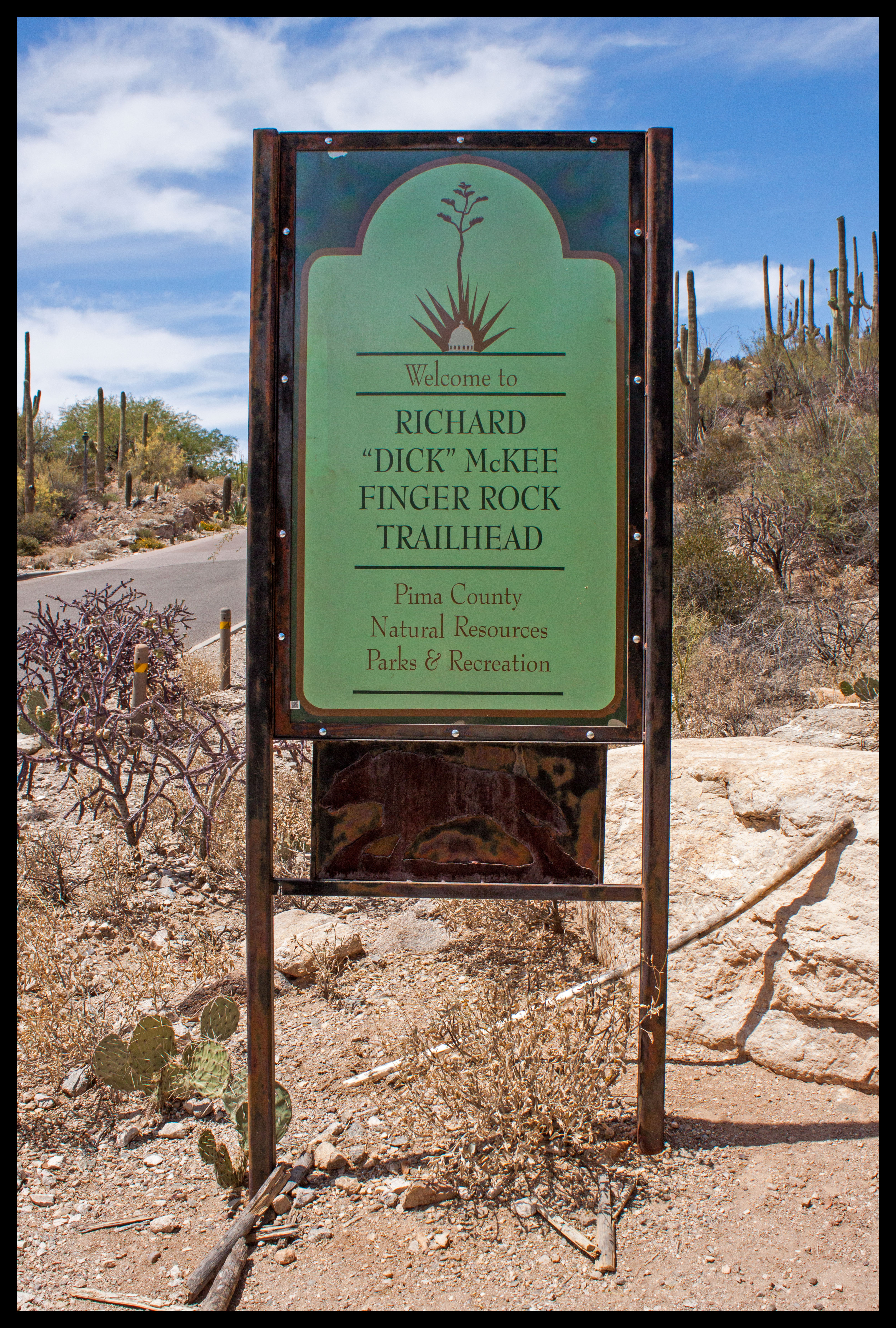
After a very long break, it’s time for a quick post on Finger Rock Trail in the Santa Catalina Mountains, north of Tucson. The end point of this trail is Finger Rock itself, located atop Mt. Kimball. The complete hike is ten miles roundtrip with a ~4200-foot elevation gain. We heard ahead of time about how punishing this hike is, so we only planned to do a six-mile roundtrip hike to Linda Vista point, which overlooks the city of Tucson. After doing the hike, I realized that you can actually see the funky finger-like rock formation from our apartment in central Tucson!

Now, you may remember my previous hike to Blackett’s Ridge, which gained 1400-feet of elevation in 1.9 miles. The ranger at the Sabino Canyon Visitor Center referred to Blackett’s Ridge as the “stair-master.” Well, Blackett’s Ridge wasn’t too bad, so I didn’t think Linda Vista’s 1900-foot elevation gain in 1.9 miles would have been much different. However, friends had warned us to bring double the water we thought we would need and they were not joking. Somehow, this hike seemed exceedingly more strenuous compared to Blackett’s Ridge. The more you know..

Finding the trailhead and parking are quite easy. Google Maps and my iPhone brought us right where we needed to be.
Finding the trailhead and parking are quite easy. Google Maps and my iPhone brought us right where we needed to be, at the northern end of Alvernon Way.

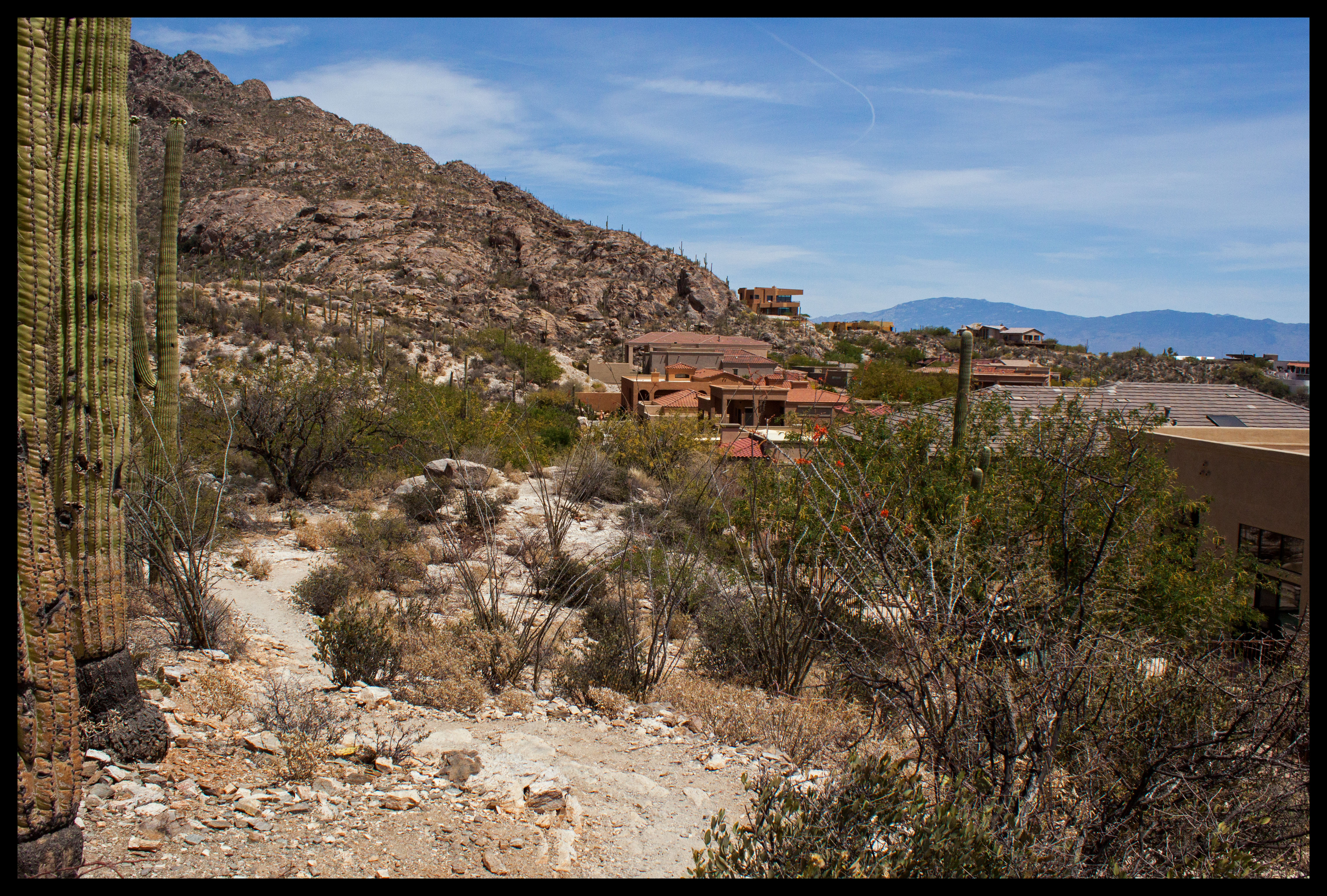
We started out around 8:30am. The first half-mile of the hike was essentially through the backyards of wealthy Tucsonites – not quite wilderness but at least the houses were pretty. After passing the final house, the hike remained level until you entered the canyon.

The trail begins near a couple of very nice neighborhoods. Eventually you find your way into the canyon and leave civilization behind.
The trail began near a couple of very nice neighborhoods. Eventually you wound your way into the canyon and left civilization behind.
Early in the morning we were lucky enough to see a few quails, and to hear many more!
Early in the morning we were lucky enough to see a few quails, and to hear many more! Possibly a Gambel’s quail, although we couldn’t get close enough to verify.

After the fairly even first mile, the trail began to climb up into the canyon. It’s easy to continue walking along a false trail through a dry riverbed, so watch out. The real trail backtracks for a few feet before the switchbacks and climbing start up the right side of the canyon.

Along the way we began to see some of the desert flowers blooming. Not sure what these are but they sure are pretty!
Along the way we began to see some of the desert flowers blooming. Not sure what these are but they sure are pretty! And not quite in focus toward the front, sadly.
More desert flowers.
More desert flowers in need of a better focus.

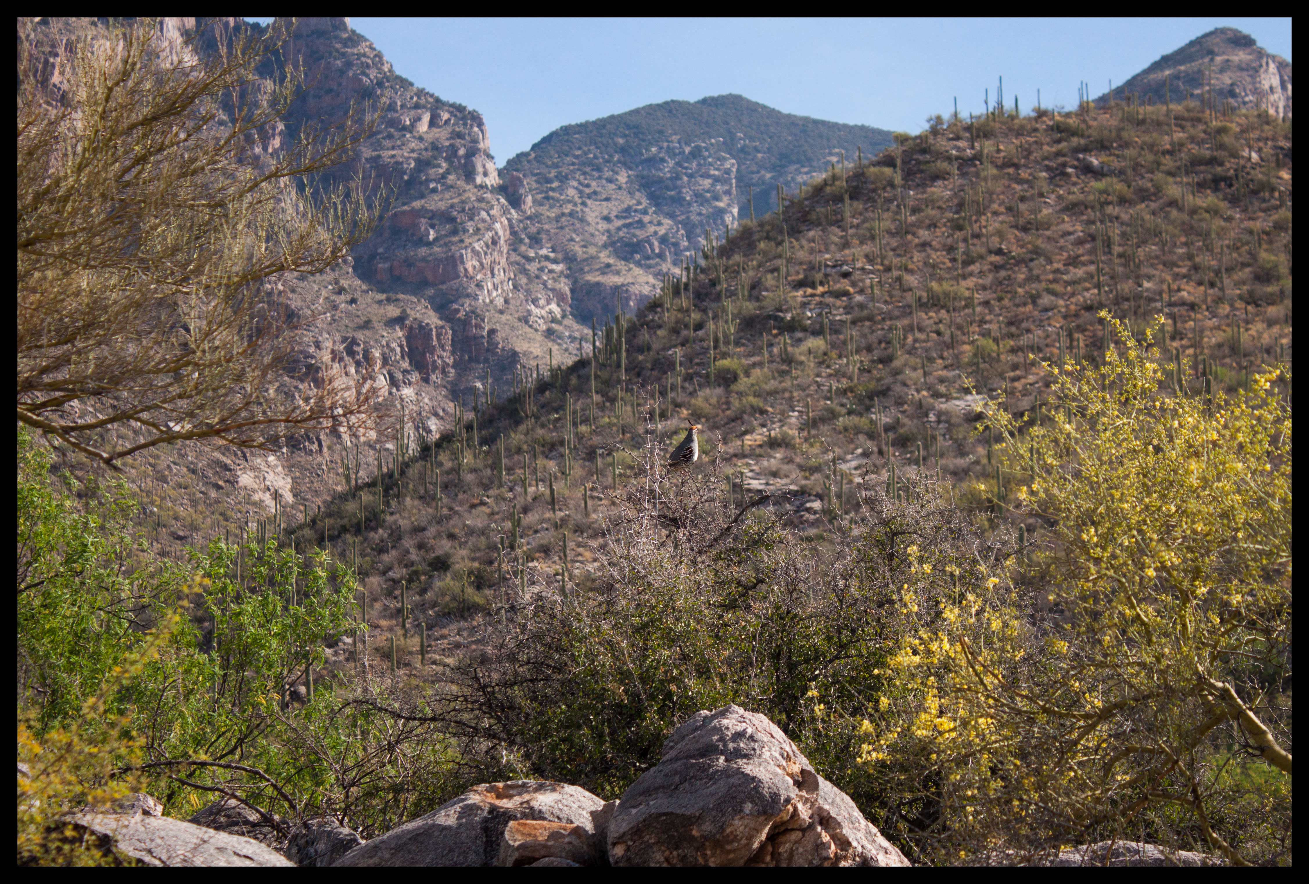
After the first few switchbacks, we were really feeling the strain. However, parts of the trail were still shaded in the morning, and we could see further and further into the canyon as we hiked.

Looking toward the back of Finger Rock Canyon, toward where I believe it intersects with Pima Canyon. Finger Rock can be seen on the left.
Looking toward the back of Finger Rock Canyon, where it widens out. Finger Rock can be seen toward the center.
A close-up of Finger Rock, which looks as if it is flashing a #1.
A close-up of Finger Rock, which looks as if it is flashing a #1. As you get further and further back into the canyon, the rock formation on the right blocks Finger Rock from view.
Some of the trail takes place on sheets of rock with perilous cliffs to your side. Take your time! This view made us feel as if we were on  a Lord of the Rings quest.
Some of the trail took place on sheets of rock with perilous cliffs to your side. Take your time! The view of the meadow up ahead made us feel as if we were on a Lord of the Rings quest.
You will eventually come up on a grassy meadow that makes a good place to stop for a rest. The hike was proving to be so strenuous that we refused to stop for snacks until we knew we were halfway done.
We eventually came up on a grassy meadow that looked like a good place for a rest. However, the hike was proving to be so strenuous that we refused to stop for snacks until we knew we were halfway done.

Right about the sixth time I thought to myself how much this hike sucks, the trail started to level out. We were wary to get too excited, but the rest of the way to Linda Vista was only moderately uphill. Eventually we reached an intersection where the canyon widened. At this point we veered off to the right, surrounded by more grass and now oak trees at our new elevation. Once we turned right and started hiking along the new canyon, we saw a lower trail off in the distance. It’s worth noting that if you do hike all the way to Finger Rock, you can take Pima Canyon Trail back down and not repeat your hike. Just make sure you leave a car at the start and end points! Fortunately for us though, Linda Vista wasn’t more than a half-mile ahead.

jh
After the trail turned right, Finger Rock is left behind and you can see a trail climbing from the bottom of the canyon up the other side. We think that this was the continuation of our trail, crossing the canyon bottom and climbing back up to Finger Rock. If so, trail descriptions indicate that the canyon bottom rises, so the elevation drop and re-gain isn’t as bad as it seems. After the climb we had just done though, it looked pretty uninviting.

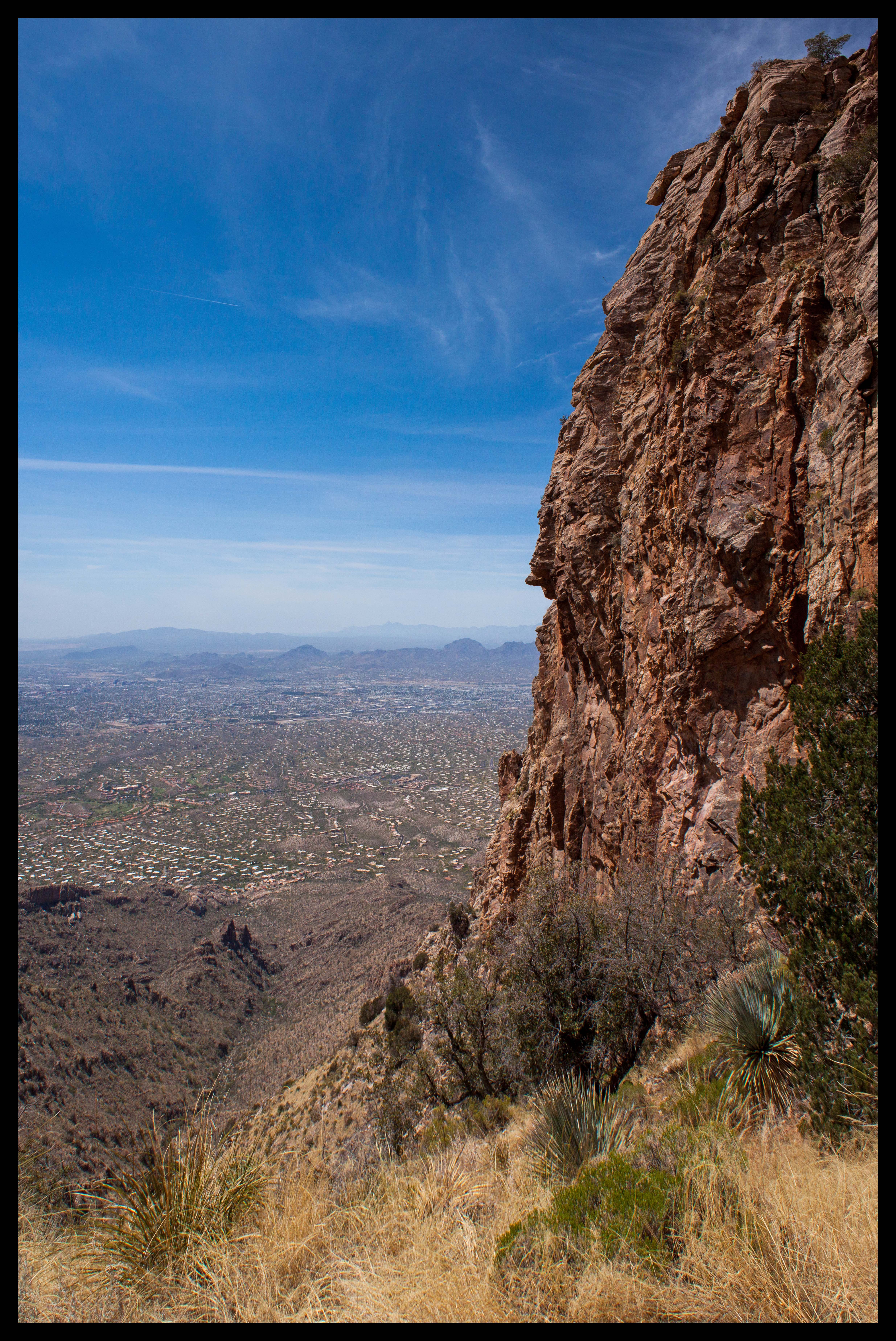
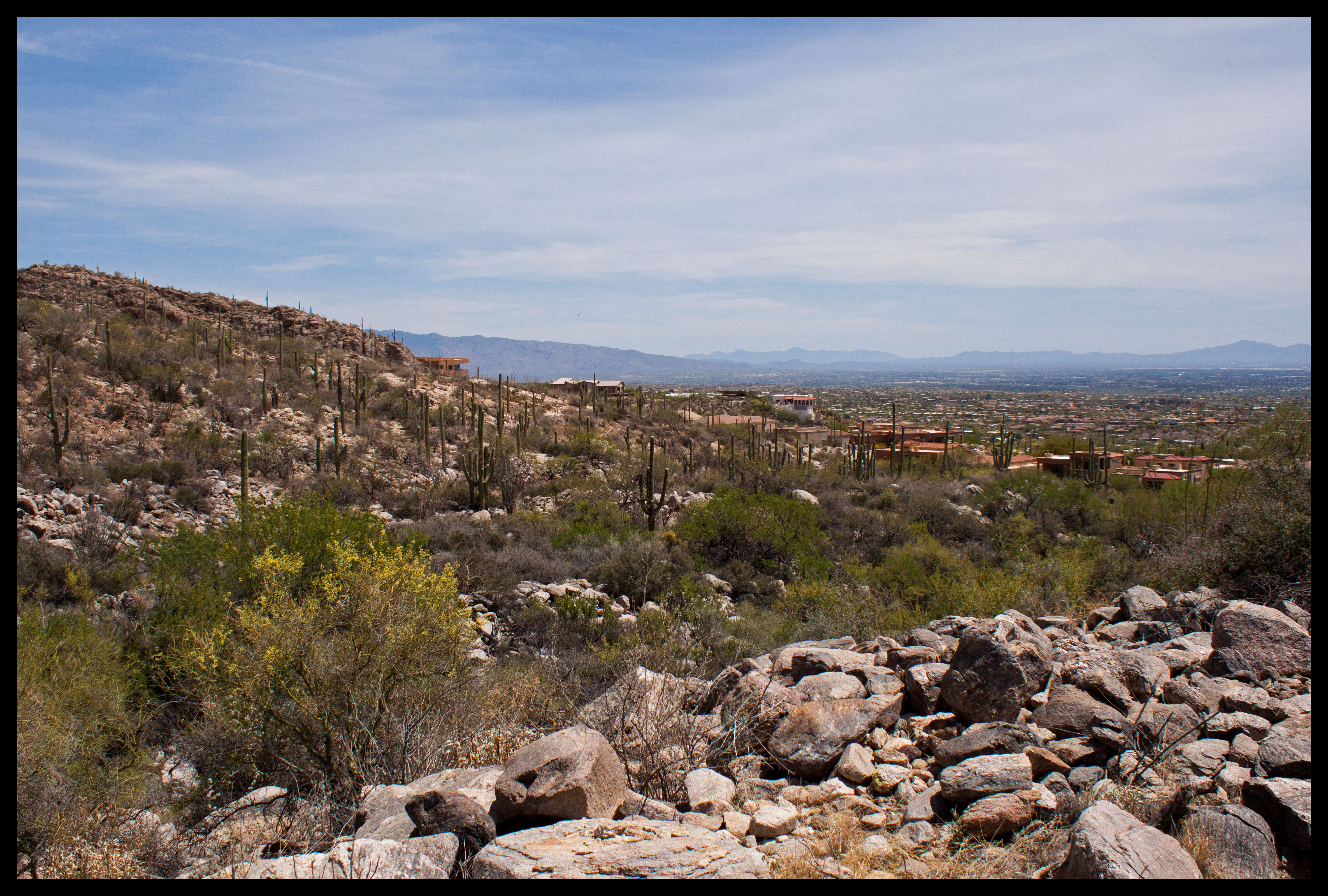
After a few tenths of a mile, the trail switchbacks started up again. There were only two or three until we reached a split. You can turn left and quite obviously continue up the switchbacks, or you can cross a line of rocks on the right. Turning right takes you another quarter-mile to Linda Vista, which offers fantastic views of the city of Tucson and a couple-hundred foot tall cliff that looks like an excellent place for rock climbing.

Overlooking Tucson from Linda Vista, relieved that we had finally reached our destination.
A wonderfully tall cliff rising above Tucson.

After a quick snack and a bit of exploration around the area, we decided to head back down. We were uncomfortably low on water at this point, but looking forward to the quick return trip. We probably got down the trail in about a third of the time it took us to climb it, estimating we took about six hours total for the six-mile hike.

The bees inspecting these prickly pear flowers never get old!
A baby branch of an otherwise full-grown cactus. It was like a toy cactus; the points were still rubbery and harmless!
We've developed a new game while hiking - count how many lizards we spot. We normally lose count at 30+ lizards, but this one in particular was striking with its rainbow colors.
We’ve developed a new game while hiking – count how many lizards we spot. We normally lose count at 30+ lizards, but this one in particular was striking with its rainbow colors. Possibly a Greater Earless Lizard.

We ran out of water with about a mile of the hike to go. So in case I haven’t emphasized it enough, bring double or triple the amount of water you think you’ll need! Seeing the city and the houses again was quite the welcome sight.

Finally, finally back to Tucson.

If you’re desperate for water when you arrive back to the car, there is a water fountain in the parking lot that we gladly used. It was a great feeling to finally arrive home after this hike. Overall, the views were excellent and there were not many people along the trail, which was nice. I wouldn’t mind returning one day and trying to reach Finger Rock, so long as we came better prepared.

Stay tuned for future posts, the next trip takes us a couple of hours outside of Tucson to see some amazing rock formations!


Leave a Reply

Fill in your details below or click an icon to log in:

WordPress.com Logo

You are commenting using your WordPress.com account. Log Out /  Change )

Facebook photo

You are commenting using your Facebook account. Log Out /  Change )

Connecting to %s