Of three short days in Maui, today was the best and the worst at the same time. We wanted to spend two days in Mt. Haleakalā National Park and with the looming government shutdown, decided that our first two days, September 29 and 30, should be spent checking that off of our list. So on Day 1 we left the hotel in Kihei around 8 am to take the famous Road to Hana.
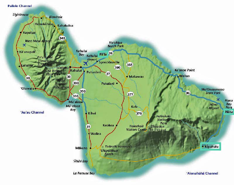
The Road to Hana is along the Hana Highway, a 52-mile stretch of road from Kahului to the small town of Hana on the island’s eastern side. Below is an example itinerary for our day:
Itinerary
8:00 – 11:00: The Drive to Hana (#60) and Take a Breather (#63)
11: 00 – 1:00: Finish The Drive to Hana, Visit Kaihalulu (Red Sand Beach) and have a short lunch
1:00 – 1:30: Go Beyond Hana (#66)
1:30 – 5:00: Take a Hike (#85) and Laze by a Mountain Pool (#68)
5:00 – 9:00: Return from Hana and Take a Slow Stroll Through Pa’ia Town (#19)
The Drive to Hana and Taking a Breather (or a few)
The drive to Hana is 52 miles along the eastern coast of the island, the first of which are on Highway 36 and the last 35 of which are Highway 360. For the life of me, I cannot figure out why anyone would classify this as a “highway.” While I am normally fine on small boats, airplanes and the backseats of cars, I seem to have a knack for catching bouts of nausea when traveling Hawaii and this road was no exception. This is not a highway with a 55mph speed limit; it is 52 miles of sharp turns, one-lane bridges, space for a car and a half, and a maximum speed limit of 25mph. By mile two I was wishing I hadn’t eaten breakfast. This is probably the most famous drive in all the Hawaiian islands, and all I can say is I’m glad I’ve gotten it over with. Doing some quick economics in my head, I determined the opportunity cost for me to willingly get in a car driving this road again would be upward of $500 (and I’m so poor I can barely afford pop tarts). All in all, we had to make about four stops on the side of the road for breathers.
One such stop came after a 2.5-mile detour through the small neighborhood of Nahiku, located just after mile-marker 25 of the road to Hana. At the bottom we were greeted with an extensive view of the Maui coastline and the opportunity to cool off near the ocean waves.
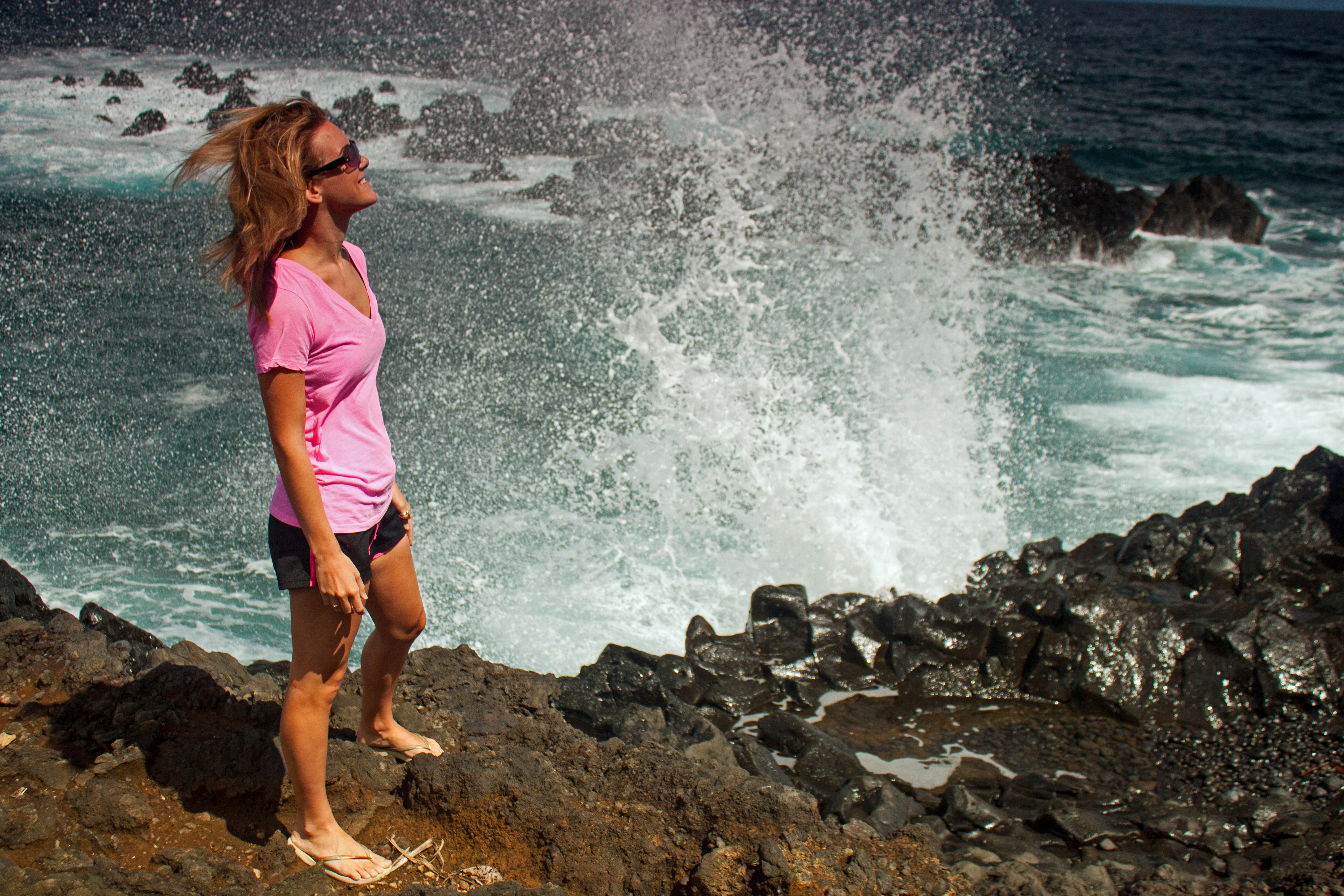
Trust me, I did not want to get back into the car after this break, but we still had about ten more miles to go till Hana.
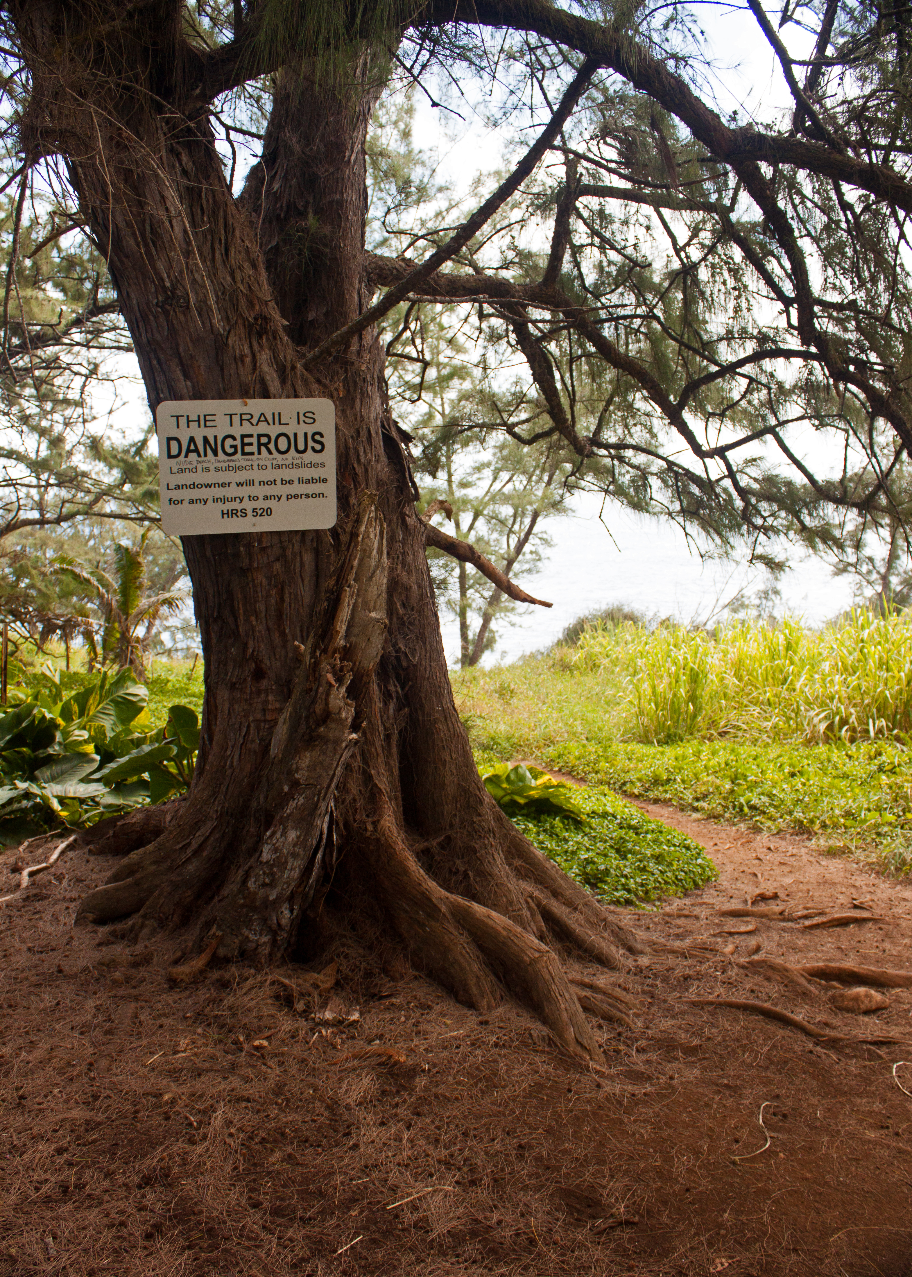
Visit Kaihalulu
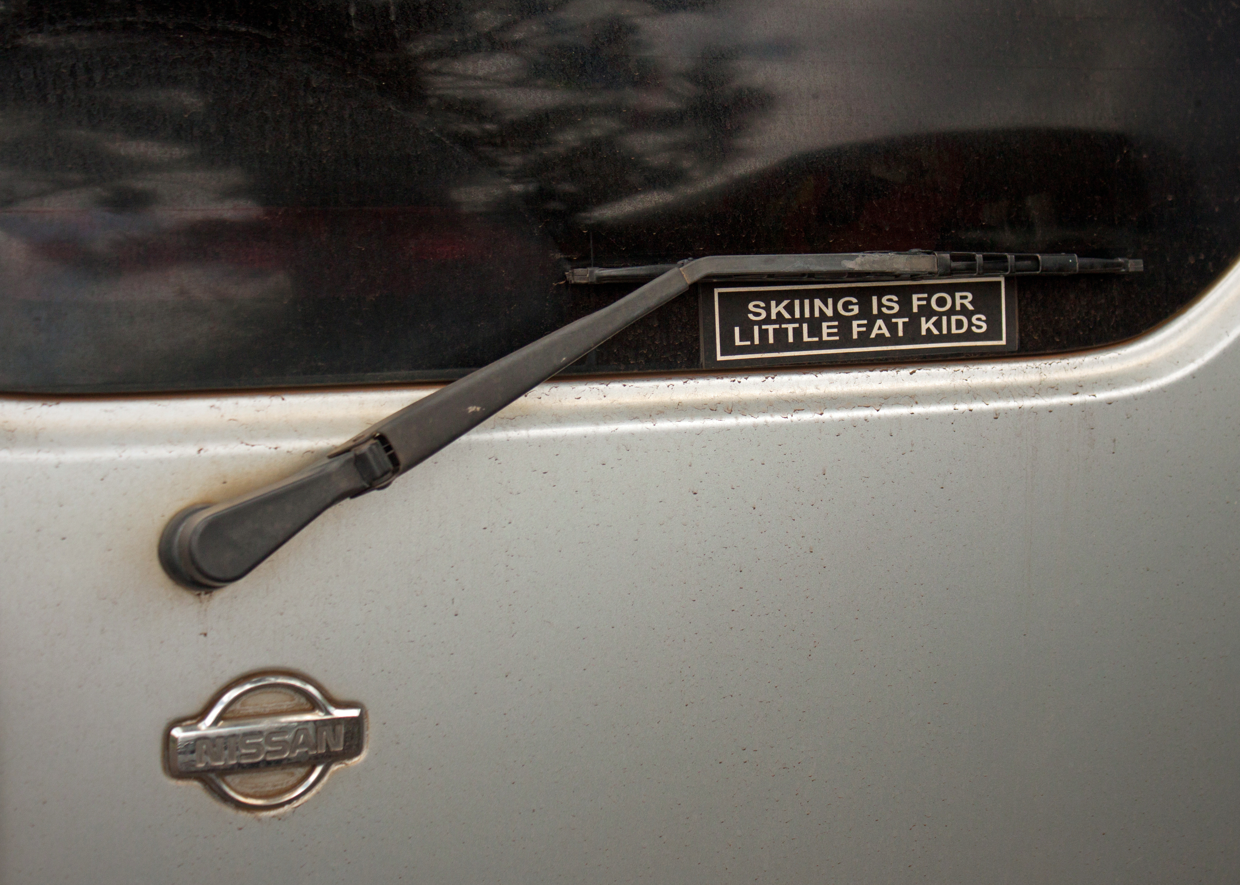
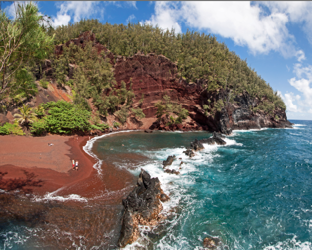
When we arrived in Hana, our first stop was the Kaihalulu Red Sand Beach. Kaihalulu is formed by the erosion of an iron-rich cinder cone, which gives it it’s rich red color. This used to be a No Trespassing area, but the owners of the land have adopted more of a “walk at your own risk” policy. We parked behind this car, which I found mildly interesting:
The hike to Kaihalulu is very short (maybe only a half mile), but pretty treacherous. The path can be slippery and crumbly; wearing sneakers is recommended. (I did it in flip flops, but only because I was under the impression that we were getting shave ice until we had already started walking.) As long as you are careful, it is a quick walk with a beautiful reward.
After carefully footing your way along the path, your first view of the beach will be from above. And it sure does look red, unlike the previously visited green sand beach (which was also a much longer hike). The sand is not at all fine; in fact, it is much more pebble-y than you would expect. It doesn’t seem very comfortable for relaxing, and the currents were rough, but it sure was quiet. (Some people were managing to swim in the somewhat protected alcove pictured below.)
After a short walk back to the car and a quick lunch, we were on our way out of Hana to the next event of the day, the Pipiwai Trail.
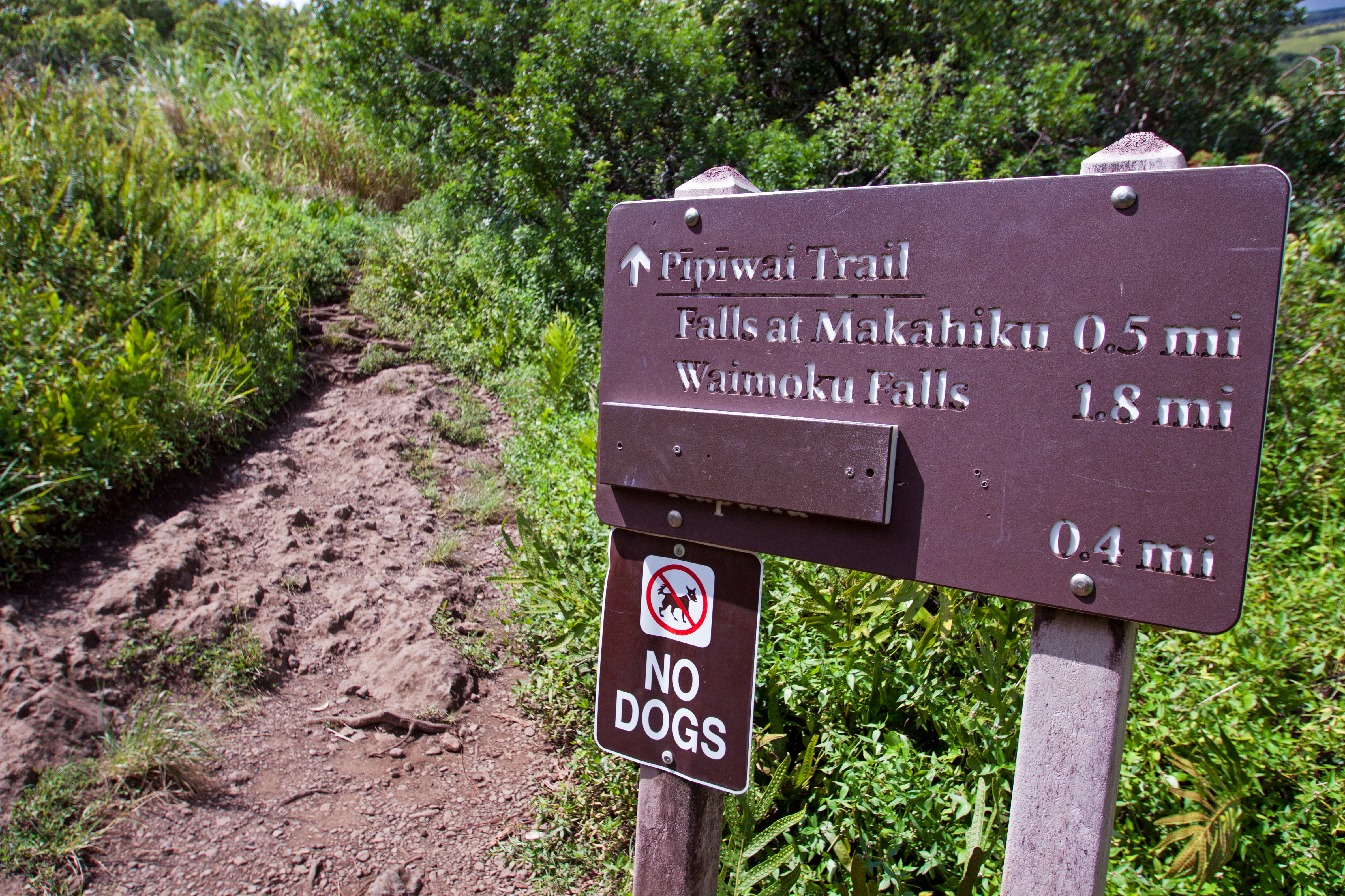
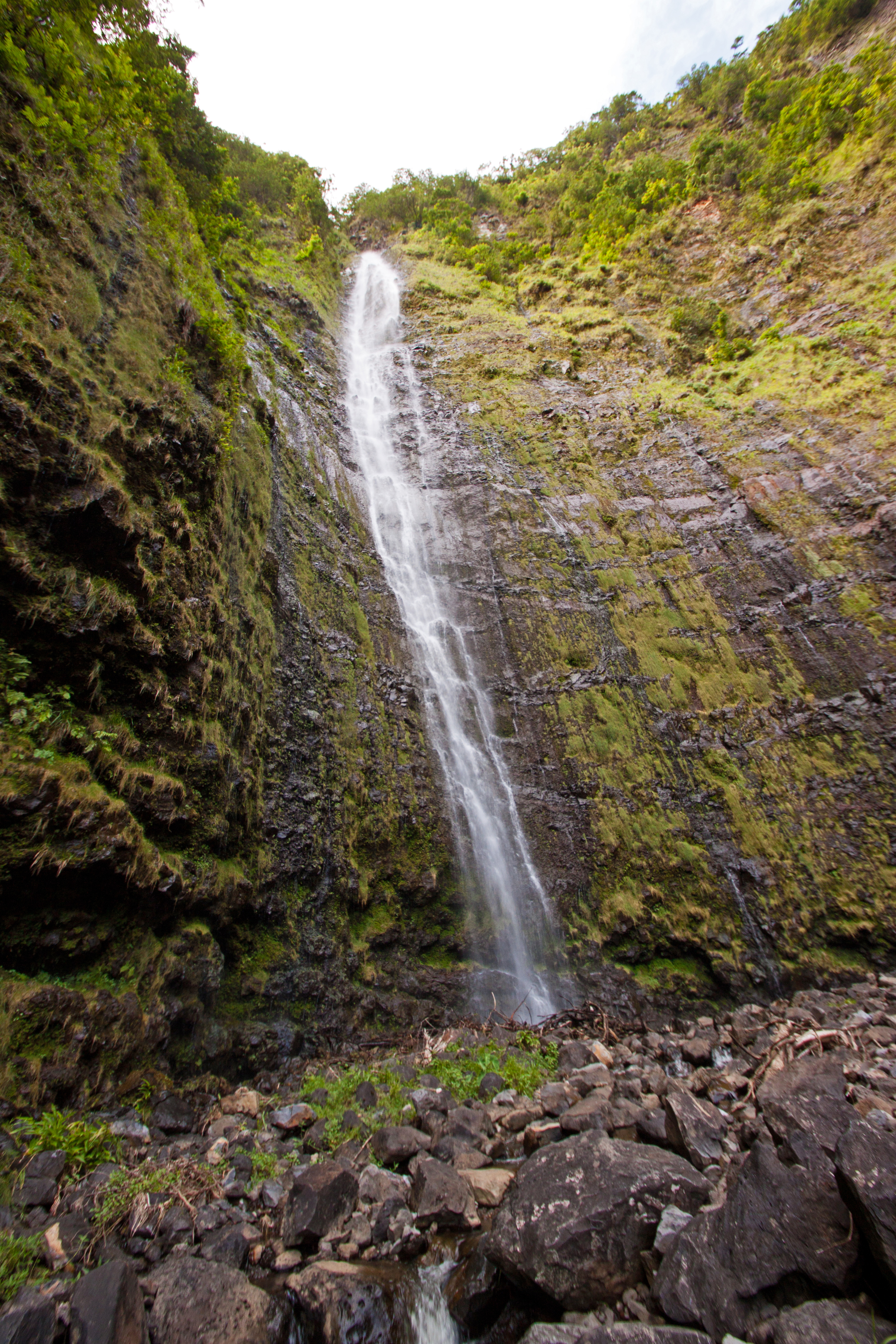
Pipiwai Trail and Waimoku Falls
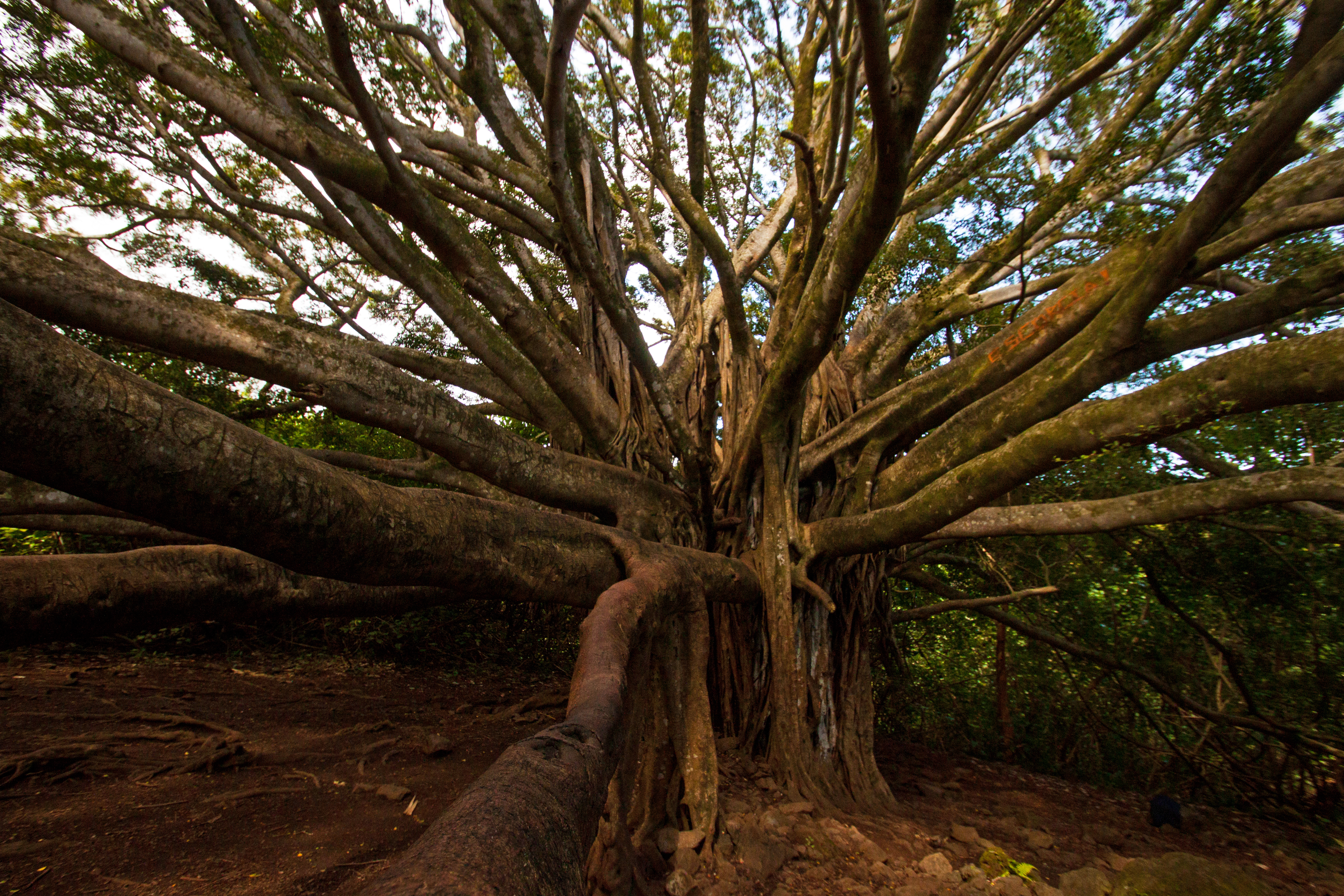
About ten miles past Hana we entered Mt. Haleakalā National Park from the east side, paying $10 for a three-day entrance. (The link currently doesn’t work due to the government shutdown.) Pipiwai Trail easily wins the Biggest Bang for Your Buck Award of all the trails I’ve done in Hawaii. In less than two miles, we journeyed past a preliminary waterfall, one of the largest banyan trees I’ve ever seen, over bridges and past more waterfalls, through a bamboo forest, ending at the bottom of the 400-foot Waimoku Falls.
Even when you’re hiking through dense forest, it remains interesting because you have to carefully watch your footing at all times.
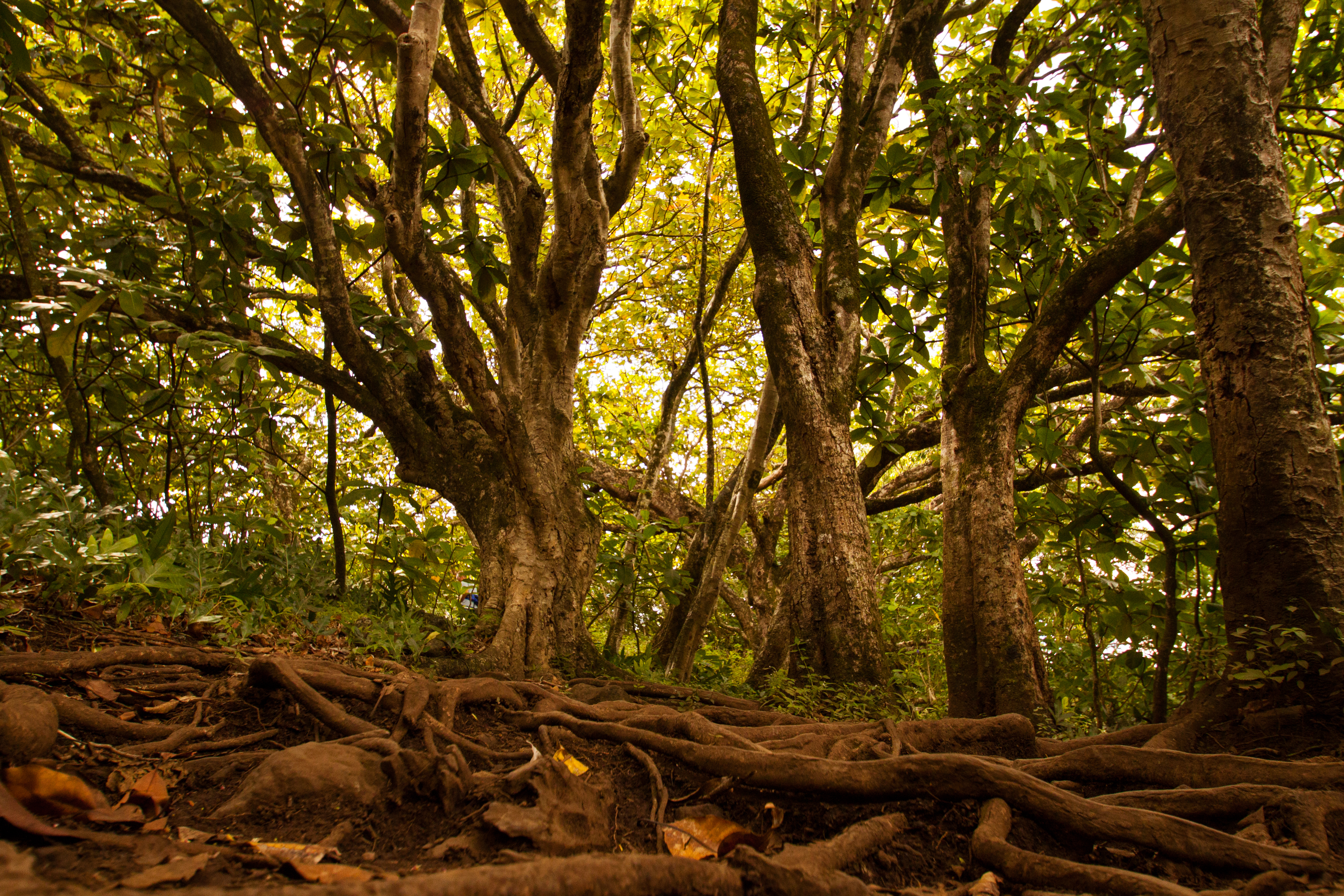
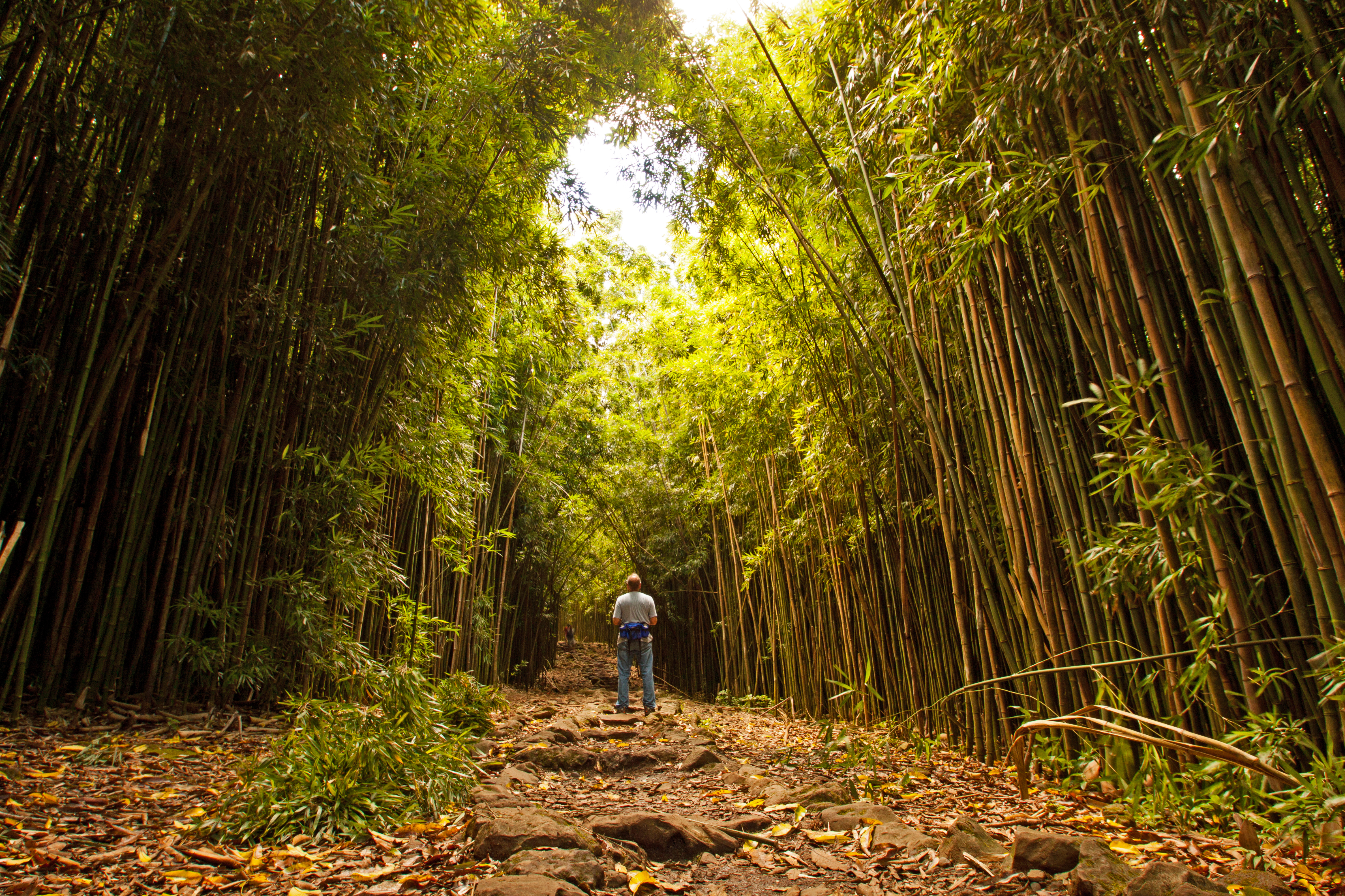
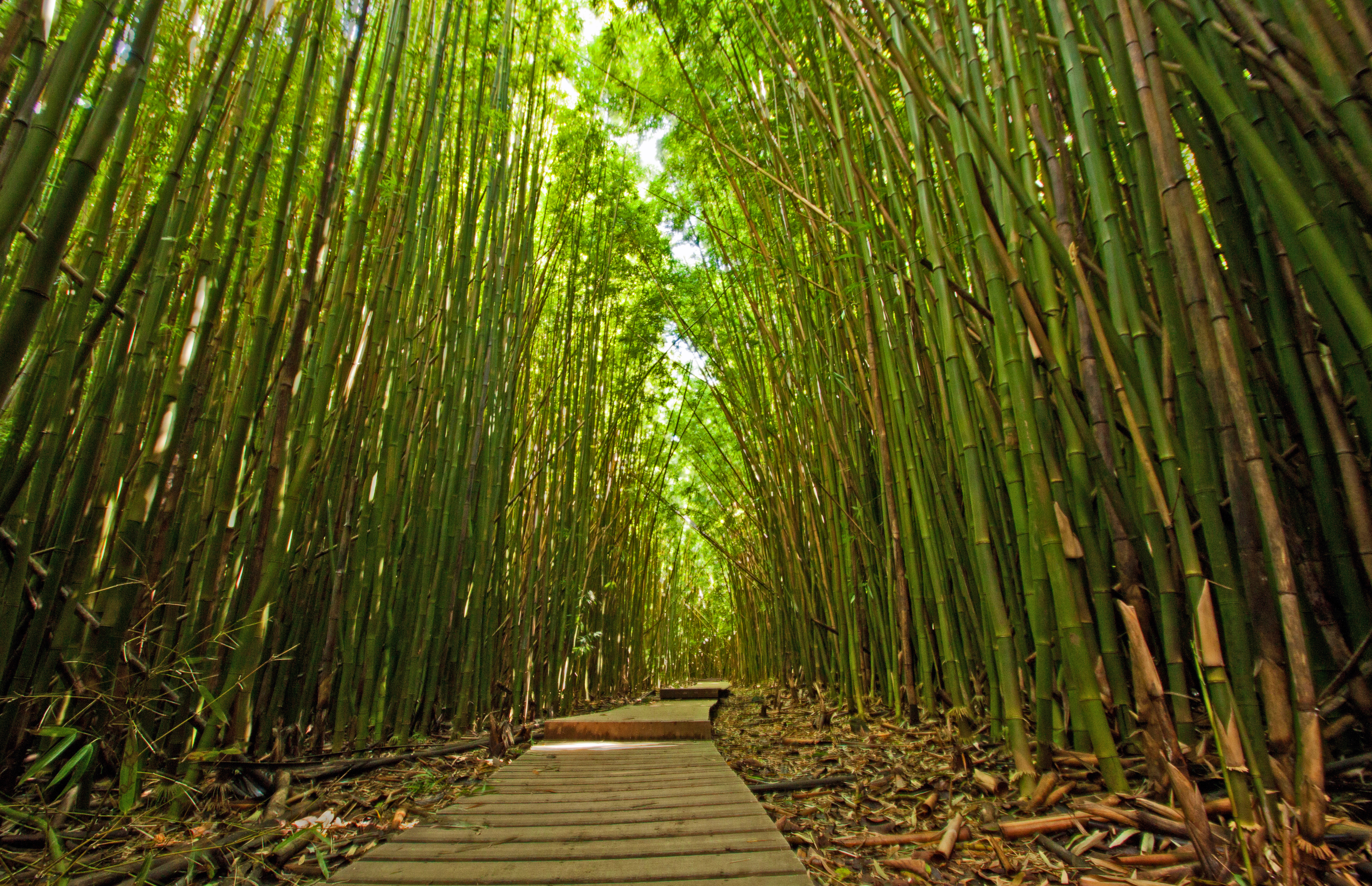
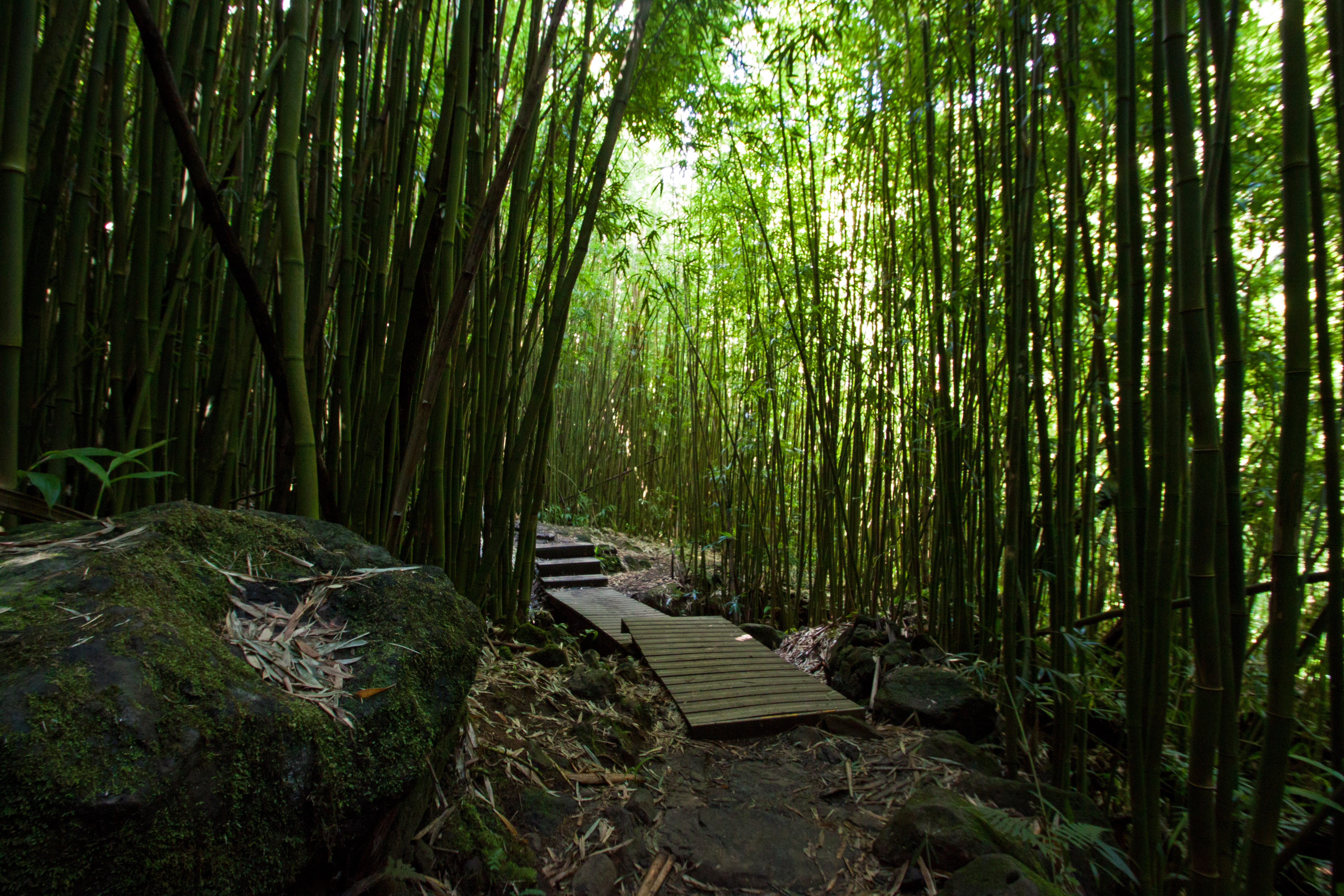
Although the waterfall was amazingly beautiful, I must say that the bamboo forest was my favorite part of the entire hike. I’ve never experienced anything quite like that before and I would eagerly do it again. Starting later in the day meant that at several times, we were the only people in sight on the trail. The walk back was just as interesting as the walk there.
After the Pipiwai Trail, we took a short half-mile walk by the O’heo Gulch and Seven Sacred Falls, a series of waterfalls pouring into the ocean, in which people sometimes swim. The name “Seven Sacred Falls” is more romantic than anything. There aren’t seven of them and they’re not sacred. They’re also fairly small, and I found the Pipiwai Trail a much more rewarding experience. However, guests will sometimes be allowed to swim in the pools when conditions are calm and clear (not when we were there). It’s probably still worth a look though if you happen to be in the area, since the trail is so short to begin with.
Take a Slow Stroll Through Pa’ia Town
After leaving Hana later than expected and ending up behind a driver who acted as if they had never seen a road before, we ended up driving the last ten miles of the road in darkness, again stopping for me to get a breather. We were hungry well before we got back to Kihei, so we stopped in Pa’ia for dinner at the Pa’ia Fish Market (they had foods other than fish). Our guide book didn’t care for it, but it was perfect for our needs: order, find a table and pick your food up when it’s ready. The seating is also cafeteria style, so although we were too exhausted to talk to our bench neighbors, I could see it being a great place to strike up a friendly conversation with other tourists. After dinner we had some delicious gelato from the Ono Gelato Company (Delicious Gelato Company, in English). All in all a good night, and although many of the stores closed early, Pa’ia looked like a great place for an afternoon stroll and some shopping.
Our next day was also spent in Mt. Haleakalā National Park, and was filled with misadventures.
Next Up: Mt. Haleakala

I think that the bamboo forest looked enchanting. Bamboo grows fast and it can be eaten, have enjoyed it in an apple and mayonnaise salad.