On the 2014 Memorial Day weekend (I know, it’s July already!), Patrick and I decided to visit Chiricahua National Monument in southeastern Arizona, a little over two hours away from Tucson. The park, nicknamed the “Wonderland of Rocks,” is famous for its tall, precariously balanced rock formations. The scenery is likely the result of a volcanic eruption that has been eroded away over millions of years. Parts of it seemed very similar to Bryce Canyon; however, this park is much more of an often-overlooked, hidden gem. We were treated to a delightful variety of scenery along our nine-mile hike.
When my dad mentioned that Chiricahua National Monument was his favorite hiking area around Tucson, we put it on our list of places to visit. While we were originally hoping to spend Memorial Day weekend in northern Arizona, this option worked out much better. The park was very sparsely populated and we had large sections of the trail to ourselves.
A long, winding road traverses the park with many scenic overlooks, and there are many hikes of varying difficulty. See a list of Chiricahua hikes. As we only had one day, we wanted to see as much as possible. Kind of on a whim, and at the advice of the park ranger at the Visitor Center, I talked Patrick into doing the “Big Loop,” which combines multiple trails into one long hike. The real goal is to get to Heart of Rocks, which is at least three miles away from the nearest parking area no matter how you approach it. This is where some of the best rock formations can be seen.
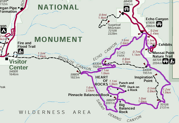
The trail to Inspiration Point is often included in this hike, but the park ranger didn’t seem to find it very inspiring, so we skipped that. When all was said and done, we probably hiked about 9 miles. Thankfully, the elevation gains and losses weren’t too bad. We did very well on our water supply, but probably should have brought more food. Even though we did this hike in late May, the higher elevation meant that it was a perfect, partly cloudy day to do this hike. I can’t imagine the weather being any better than it was. We parked at the end of the road at Massai Point Nature Trail. It was a pretty small parking lot, but nowhere near full when we were there.
We followed the above trail in a clockwise fashion, starting with some nice overlooks before we descended into a valley and hiked along a riverbed.
Shortly after passing the turnoff to Inspiration Point, we came to the southern edge of the park, which provided outstanding overlooks to the surrounding mountain ranges. Unfortunately, a wildfire must have passed through a couple of years ago, because this section of the trail was mostly dead trees.
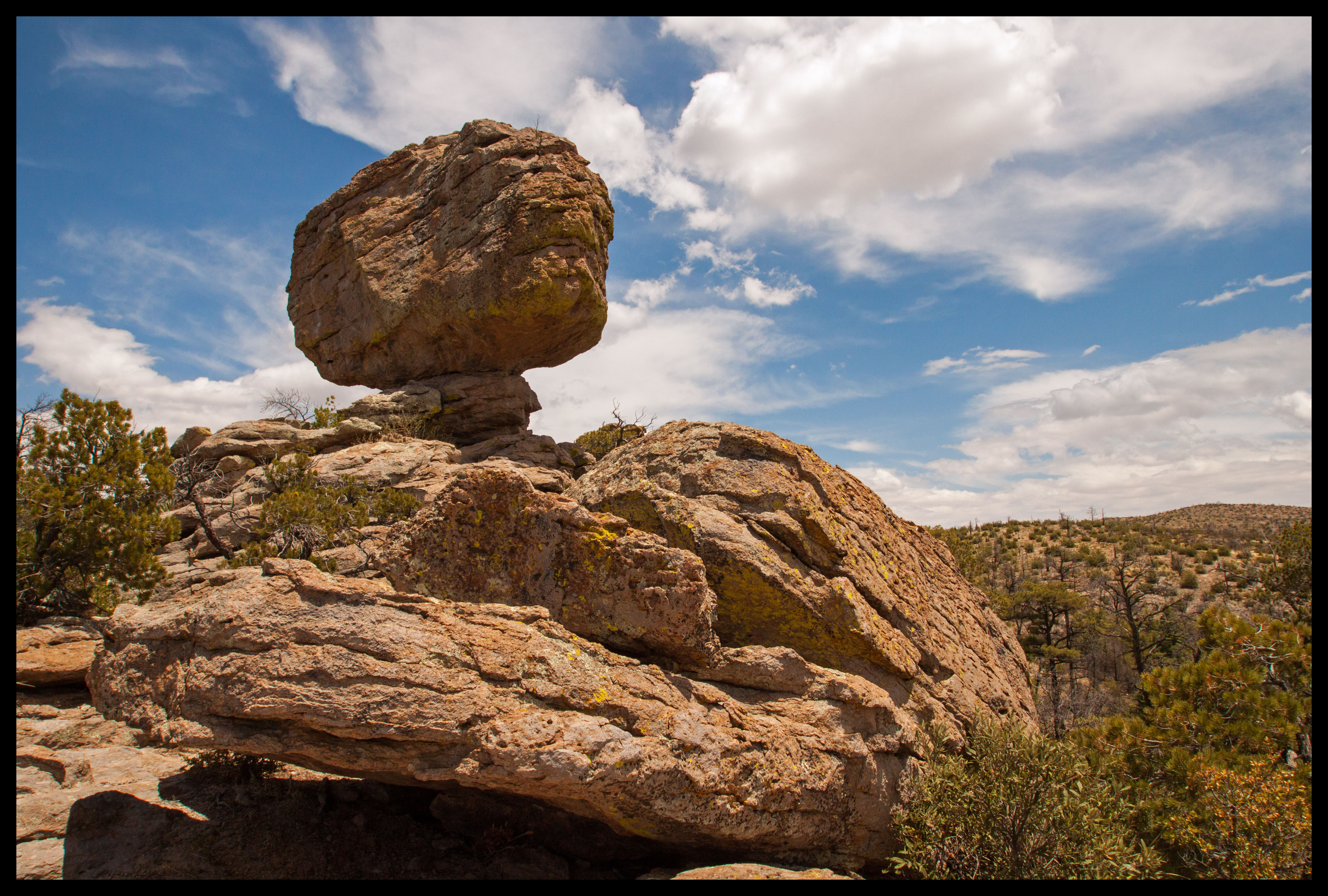
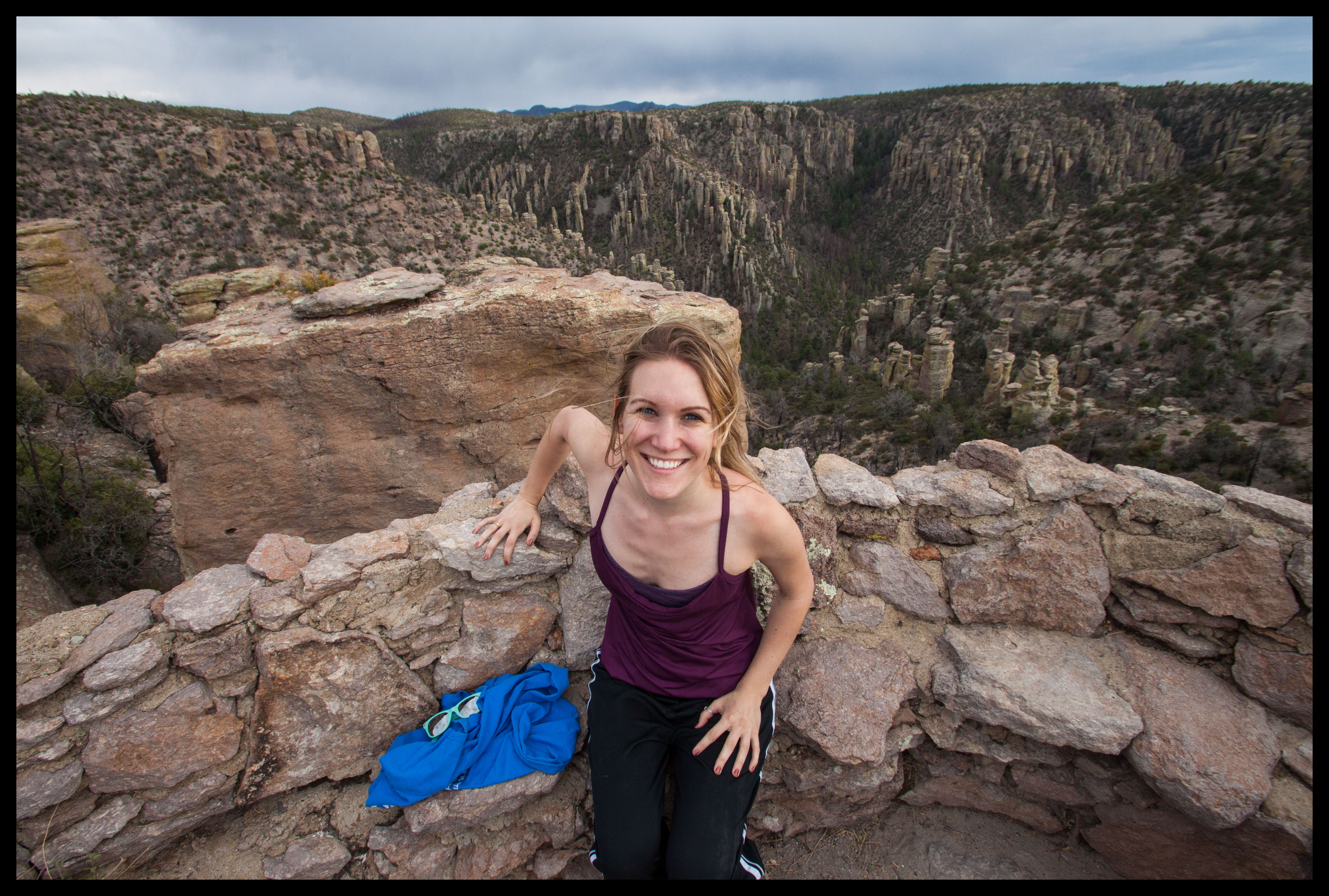
Continuing along the southern edge, we approached Big Balanced Rock and the Heart of Rocks area, our halfway point for the hike. Looking back, we hadn’t seen anything truly amazing quite yet, but we were still thrilled with the moderate trail and excellent weather.
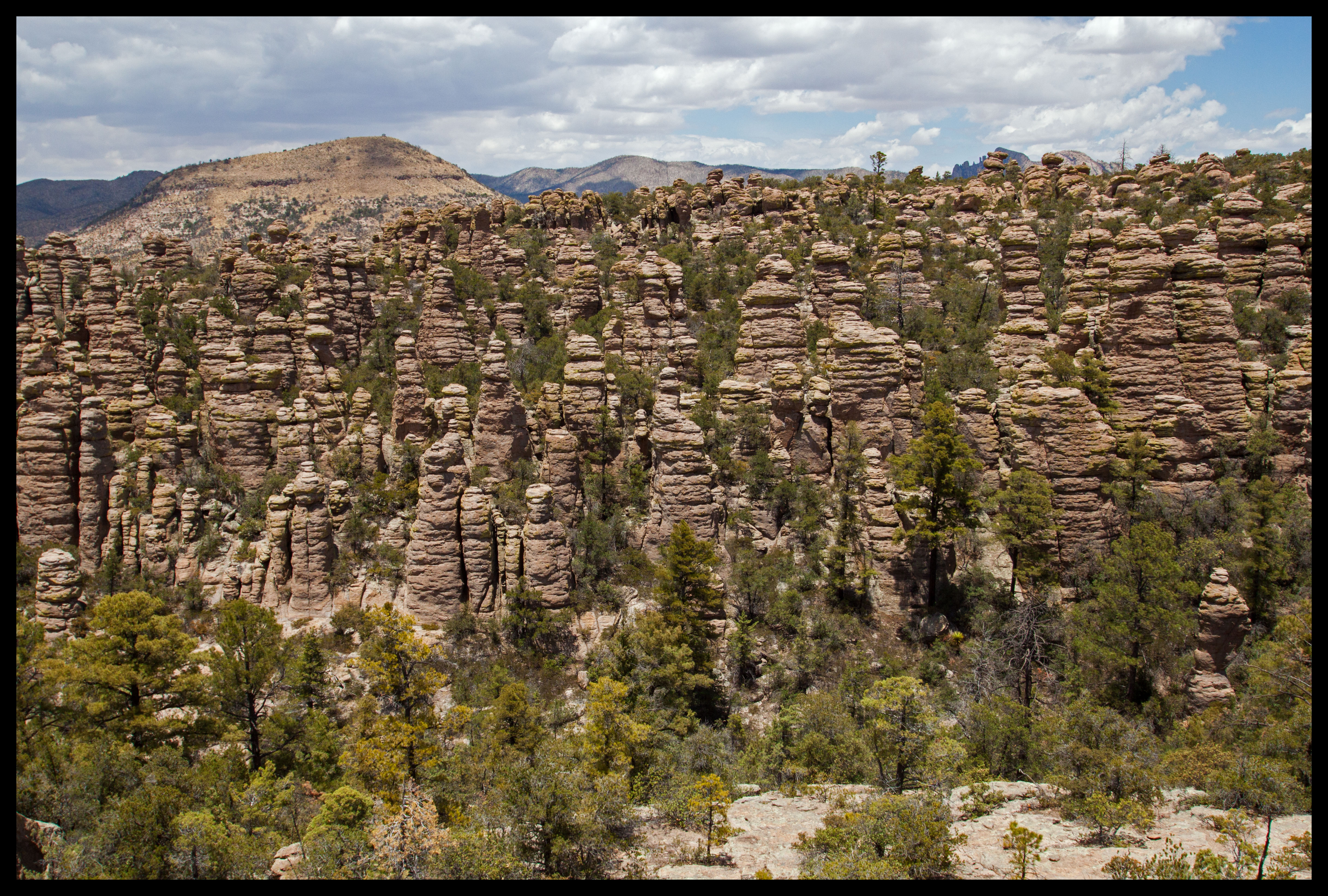
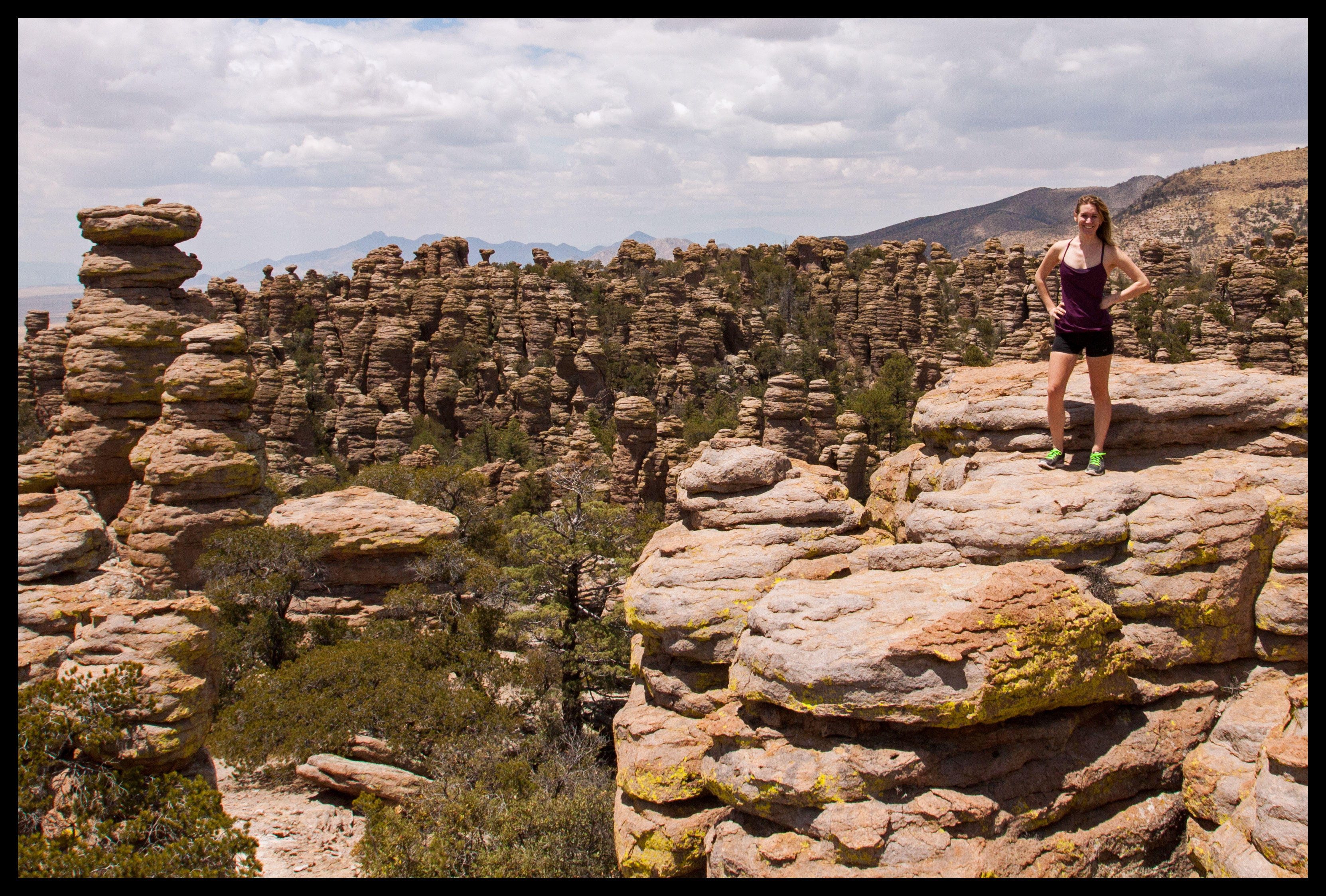
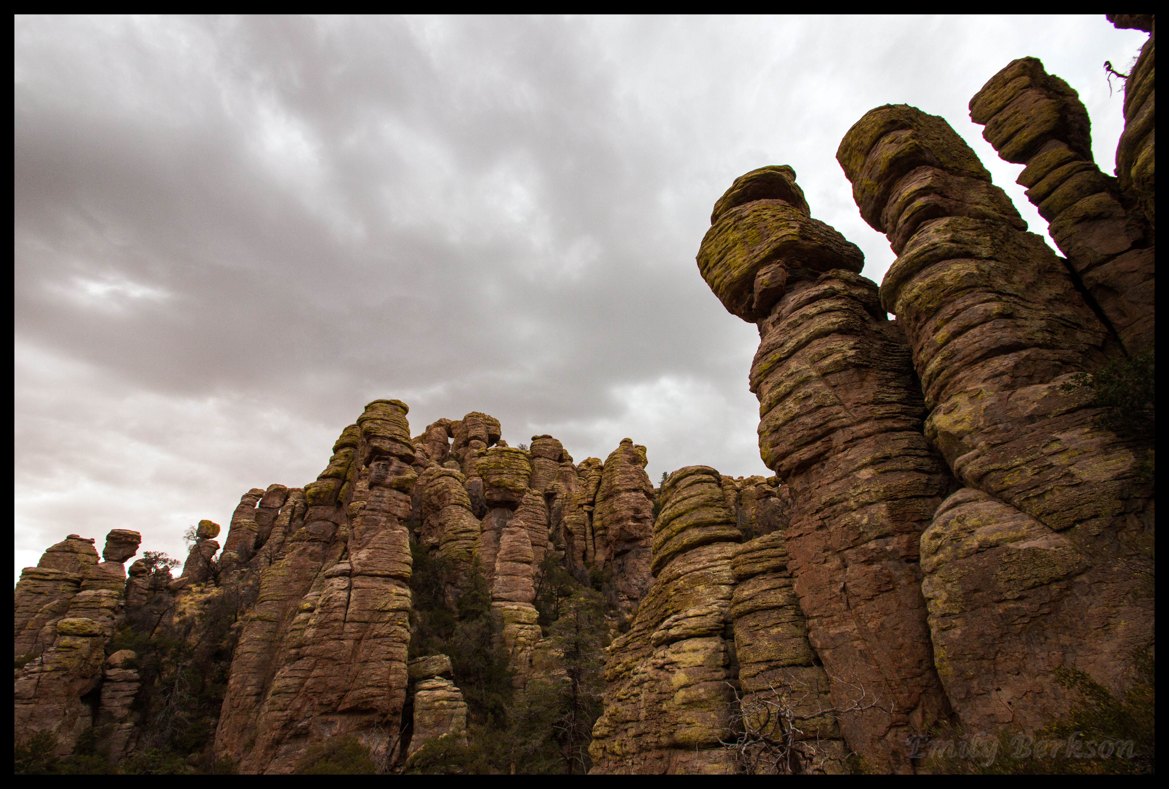
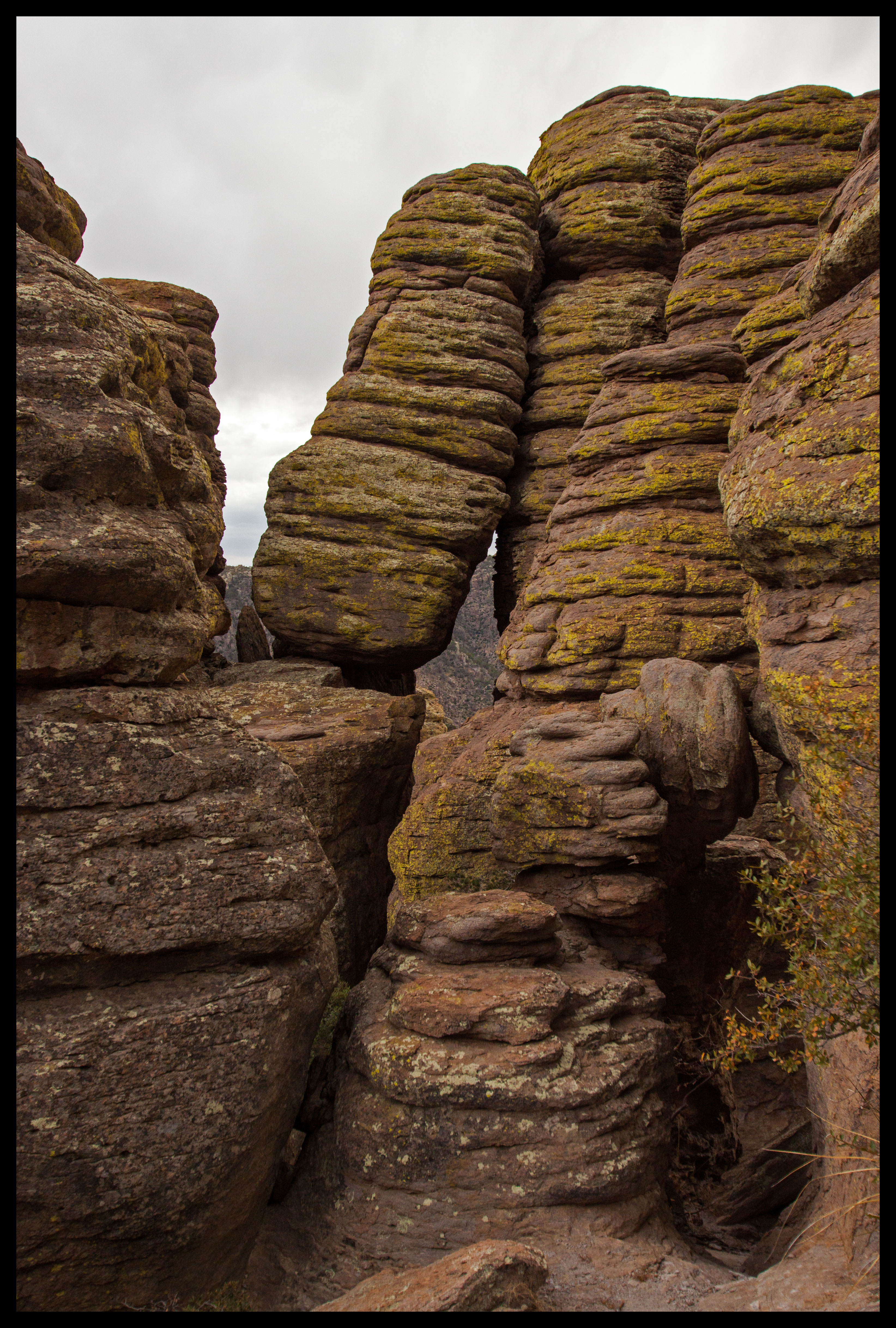
After about 3.5 miles, the time came to enter the Heart of Rocks loop. As I mentioned before, this is where all of the secret gems are. The trail was a bit confusing here, but eventually we found our way. We went clockwise around this loop, and started by climbing up a steep set of rock stairs. The rest of the loop was gradual.
Big Balanced Rock, the top left photo in the above set, seems to be one of the park’s biggest and best formations. It has a diameter of 22 feet, weighs 1000 tons, and stands 25 feet tall. Quite a precarious balance!
After finishing the Heart of Rocks loop, we were about halfway through the hike. We took this opportunity to munch on some pretzel rolls and candy (not the best planning in the world). Protein bars and sandwiches would have been more ideally suited to this hike.
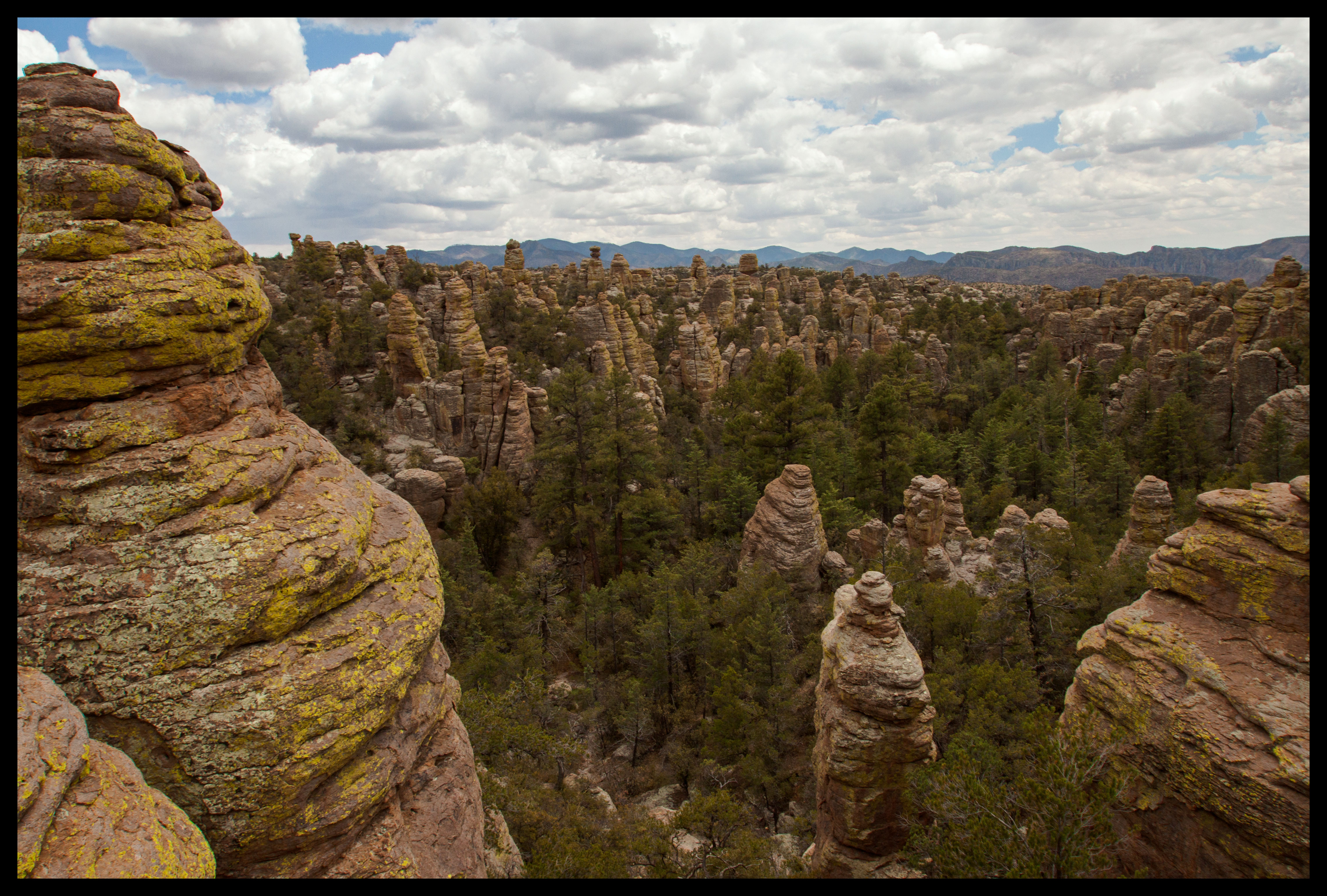
We then continued along the trail, this time into Sarah Deming Canyon. Here we got yet another outstanding set of views, this time of many rock formations at a distance. The trail again changed to become more foresty as we descended toward another riverbed.
The scenery and surrounding landscape in Sarah Deming Canyon were lovely, although different from Heart of Rocks. The trail seemed to perfectly segue between landscapes, giving you just enough time to hike through one area, and transitioning before it got boring or dull. It truly felt like a nine-mile hike, not as if we hiked the same one mile nine times in a row.
Sarah Deming continued into Echo Canyon, which Patrick dryly noted seemed to be absent of any echoes.
The last half-mile of the trail from the Echo Canyon Parking lot back to the Massai Point Nature Trail was probably the dullest part of the day. It parallels the road though, so it was at least a nice reminder that we were approaching civilization once again. On the way back to the car we stopped at one more eastern-facing overlook along the nature trail.
It was obviously a long time ago, but I would guess we spent about 7 hours doing this hike, from 10:30am-5:30pm. Keep in mind, we go slow with many stops for pictures and climbing. I’m sure serious hikers could do it in much less time.
This hike through Chiricahua was probably the best one I’ve done in the past six months of being back in Arizona. It was well worth the two-hour drive and full-day hike to experience what this park has to offer. The wonderful weather and low population of hikers just added to the enjoyable day. I highly recommend this hike and hope anyone else who tries it gets to experience the enjoyable day we had!

Nice comparison to Bryce, much of which is viewable from above or from below. Wonder how long before the Balancing Rock will no longer!
Interesting thought, Roy. I never imagined what it would be like to stand there as the rock fell.