This adventure actually happened several weeks ago, but unfortunately I was having too much fun to take some crucial pictures! I’ve only recently gotten back to take a few more pictures to complete the blog post.
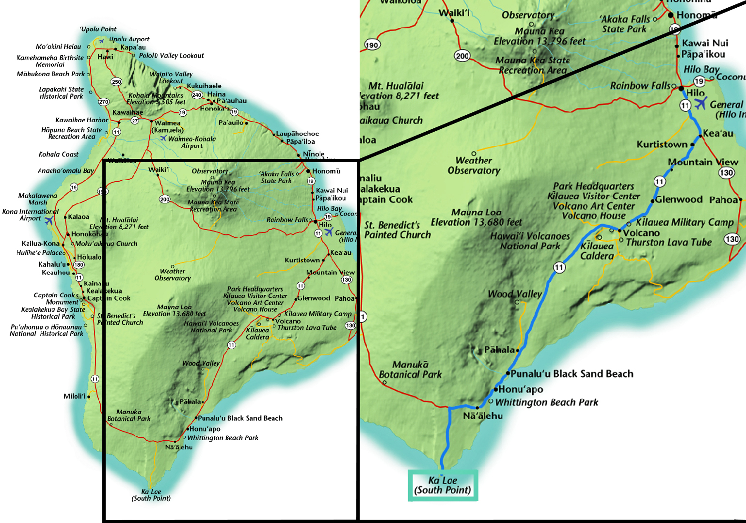
Several Saturdays ago, about ten other interns and I (from several different observatories) made the venture to Ka Lae, the southern most point of the United States, and to the green sands beach about to miles away. Papakōlea Beach is one of two green sands beaches in the world, the other being on the Galapagos Islands. This adventure checked off #32 (Ka’u: South by South). Ka’u is the district we were in, while Ka Lae is where we were visiting. Visiting the southernmost bakery of the United States is recommended, but we chose to visit the southernmost bar instead. Below is the usual map showing where we were in relation to Hilo and what route we took driving.
This was a leisurely day for us, so we started driving from Hilo around 10:00 and returned at 9:00.
Itinerary
10:00-12:00: Ka’u: South by South (#32)
12:00-1:30: Cliff dive and swim
1:30-5:30: Hike to Papakōlea Beach
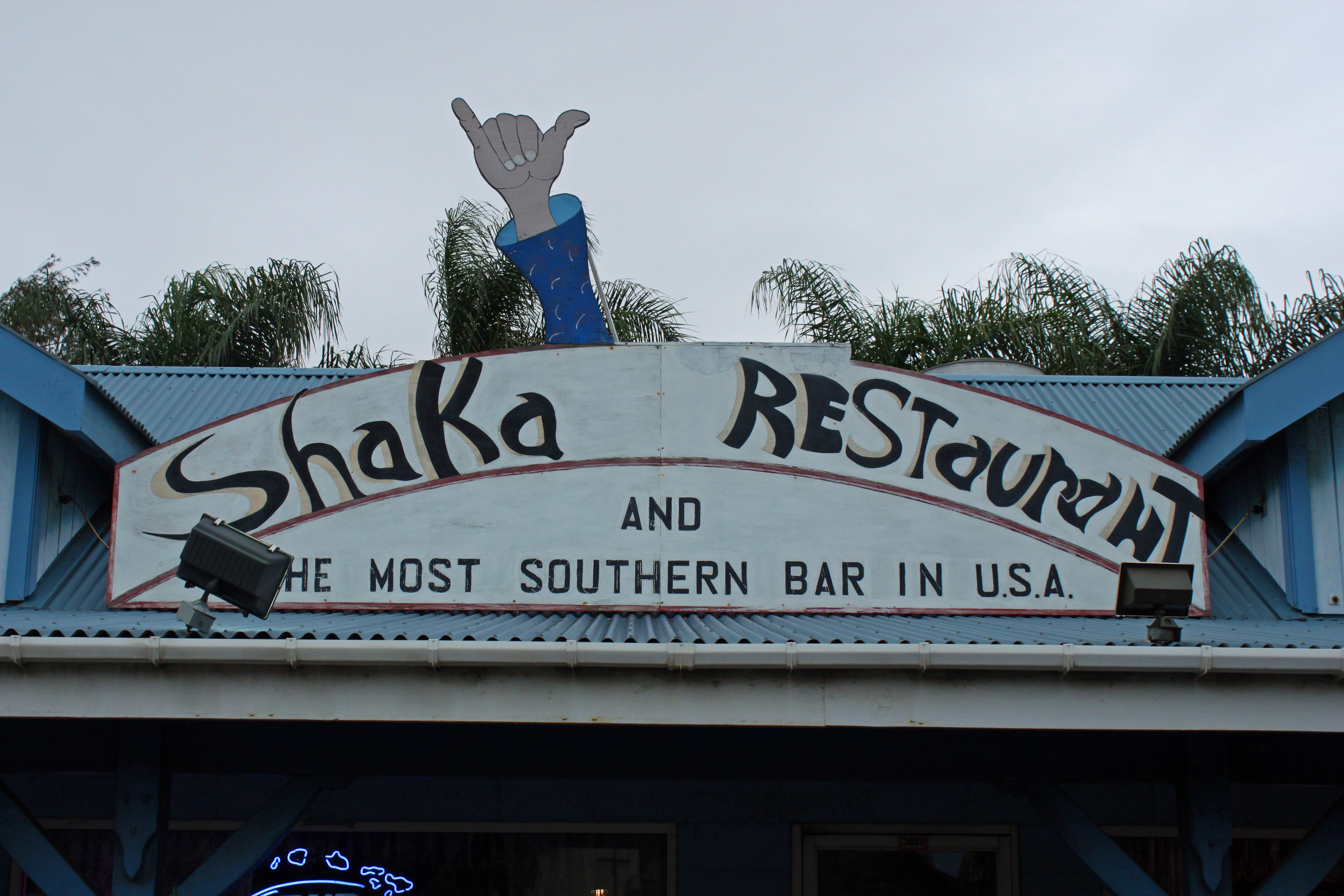
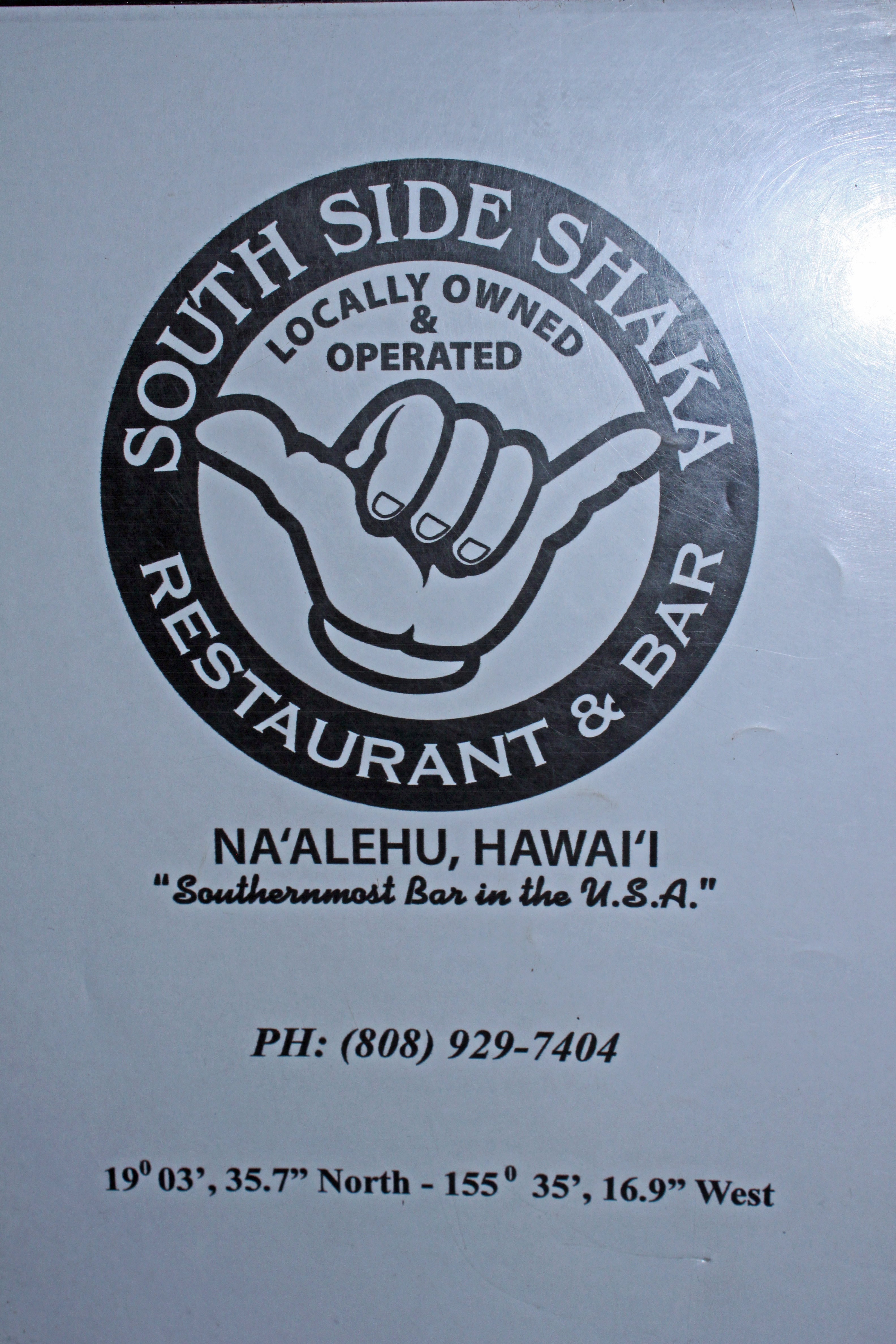
5:30-7:00: Dinner at the southernmost bar in the USA (South Side Shaka)
7:00-9:00: Drive back to Hilo
Ka Lae
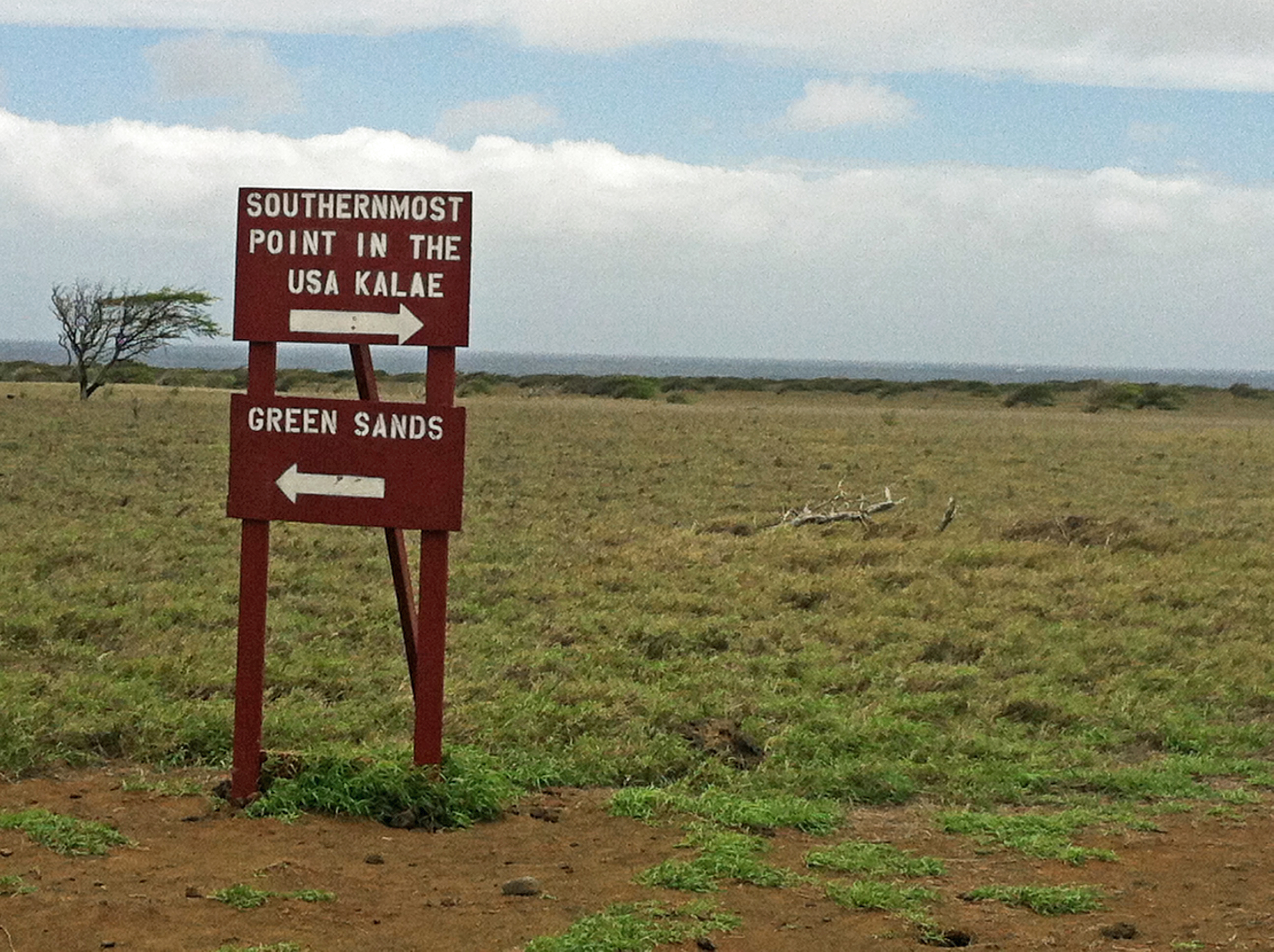
Ka Lae is the Hawaiian name for South Point, the southernmost point in the United States. It is thought to be one of the earliest Hawaiian settlements, first discovered by the Polynesians. Ka Lae was and is a very popular location for fishing, despite the strong winds and ocean currents. The first time I went with friends, it was a beautiful sunny day with dozens of people milling around. The second time I went, it was cloudy and windy making for extremely rough waters. We were some of the only people there. Ka Lae is pretty far away from any other main attractions (~2 hours), so many people skip this. There’s not much to do here besides take a picture of the sign… Unless you like adventure.
When you arrive to Ka Lae you’re only a few feet from the edge of a 45-foot cliff overlooking the ocean. This cliff makes the ultimate adventure for daredevils visiting Hawaii. When we arrived there were at least a dozen people throwing themselves off of this cliff repeatedly. (They probably call it diving; to me it looked like sheer lunacy.) Several people in our group wanted to jump but only one ended up actually doing it. Below is a picture of two of us standing mere feet away from the edge of the United States, with nothing behind us until Antarctica.
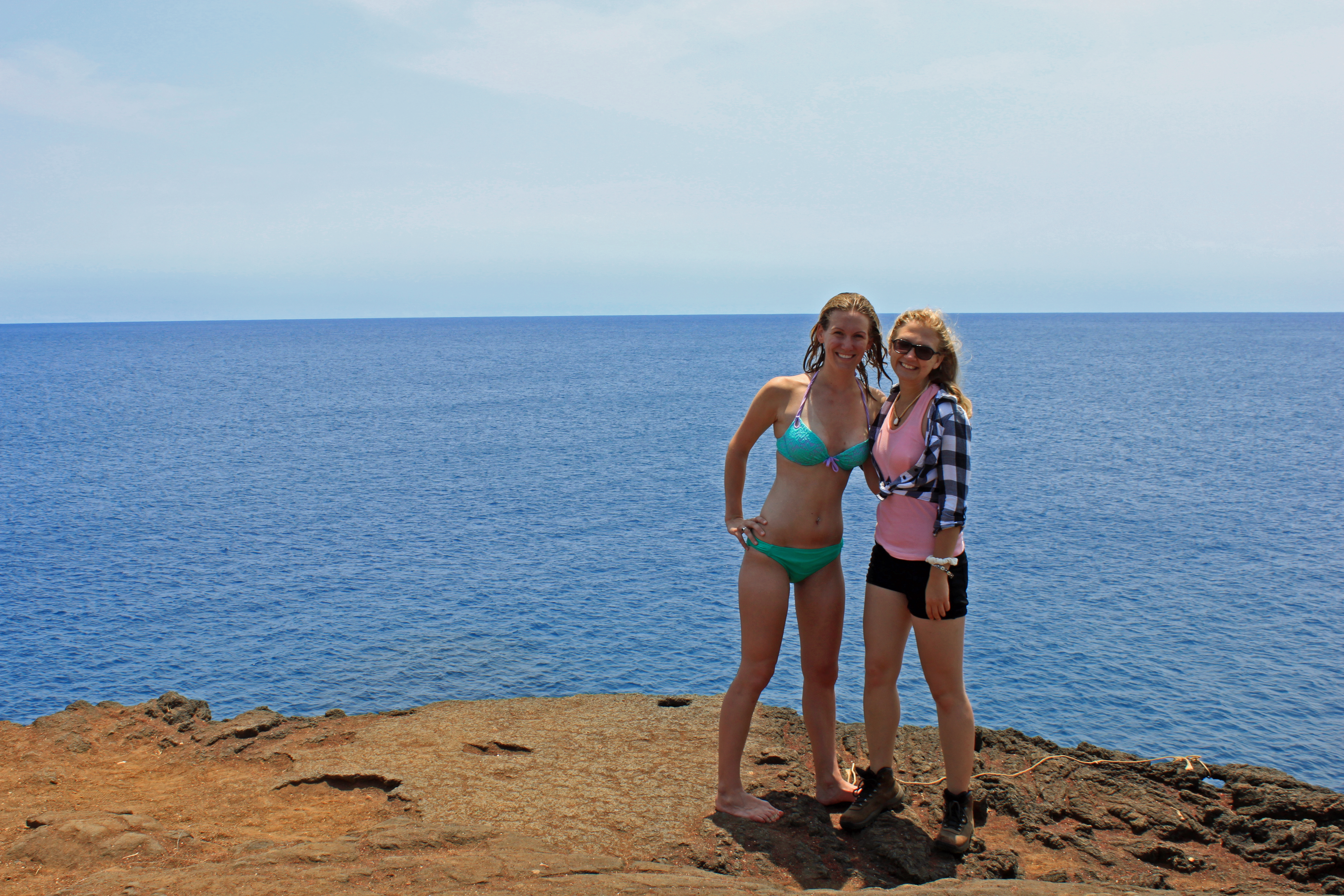
I should note that the jump itself actually seemed pretty safe: when you stand on the edge of the cliff, you’re standing on top of an ocean cave, not continuous rock. So after the first ten feet of the jump, there’s no rock for you to scrape. My big fear was controlling yourself for landing, i.e. not doing a 45-foot bellyflop. Being scared of heights, I only peeked over the edge once or twice. I was more interested in the aforementioned ocean cave, which you could also jump in to.
The daring folk jump from 30 feet up, and most consider this to be the more dangerous jump. You pass through more rock the higher you jump, and the water level changes rapidly. The swells were about 6 feet when we were there. Still, I preferred the ocean cave because you could climb down to about 10-feet above the water before jumping (perfect for a scaredy cat like me!). I heard estimates for the water there being about 30 feet deep, so no one was particularly concerned about scraping anything once in the water. After jumping, you could perch on the edges of some rocks for awhile while watching other people come down, and then you could swim or climb out. Climbing out of the cave led you several yards away from where you jump in. If you swim out, you end up right underneath and to the side of where people are jumping off of the cliff, which makes for some nice views. You can climb 45-feet up an extremely unsafe-looking ladder, or you can swim around a few extra yards and find a nice rocky path to climb.
SPECIAL NOTE: After all this talk about jumping, it’s worth noting that there were probably a dozen people jumping off of the cliff and into the cave when I first went to South Point. There were several local people there being particularly helpful in the cave, showing when to jump and where to exit. The second time we went however, no one was jumping or swimming due to the awful currents. The boulders surrounding the cave had shifted completely, and the South Point sign (which I wanted a picture of) seemed to have disappeared (possibly due to winds from Tropical Storm Flossie?). Thankfully I was lucky enough to see South Point “in action” the first time I went there, but clearly it is not always safe there. If anyone besides my family and friends happens to stumble across this blog and decides to jump from South Point, please use common sense!
Once our group had finished jumping, swimming and watching others jump, we drove a few short miles to the parking for Papakōlea Beach.
Papakōlea Beach
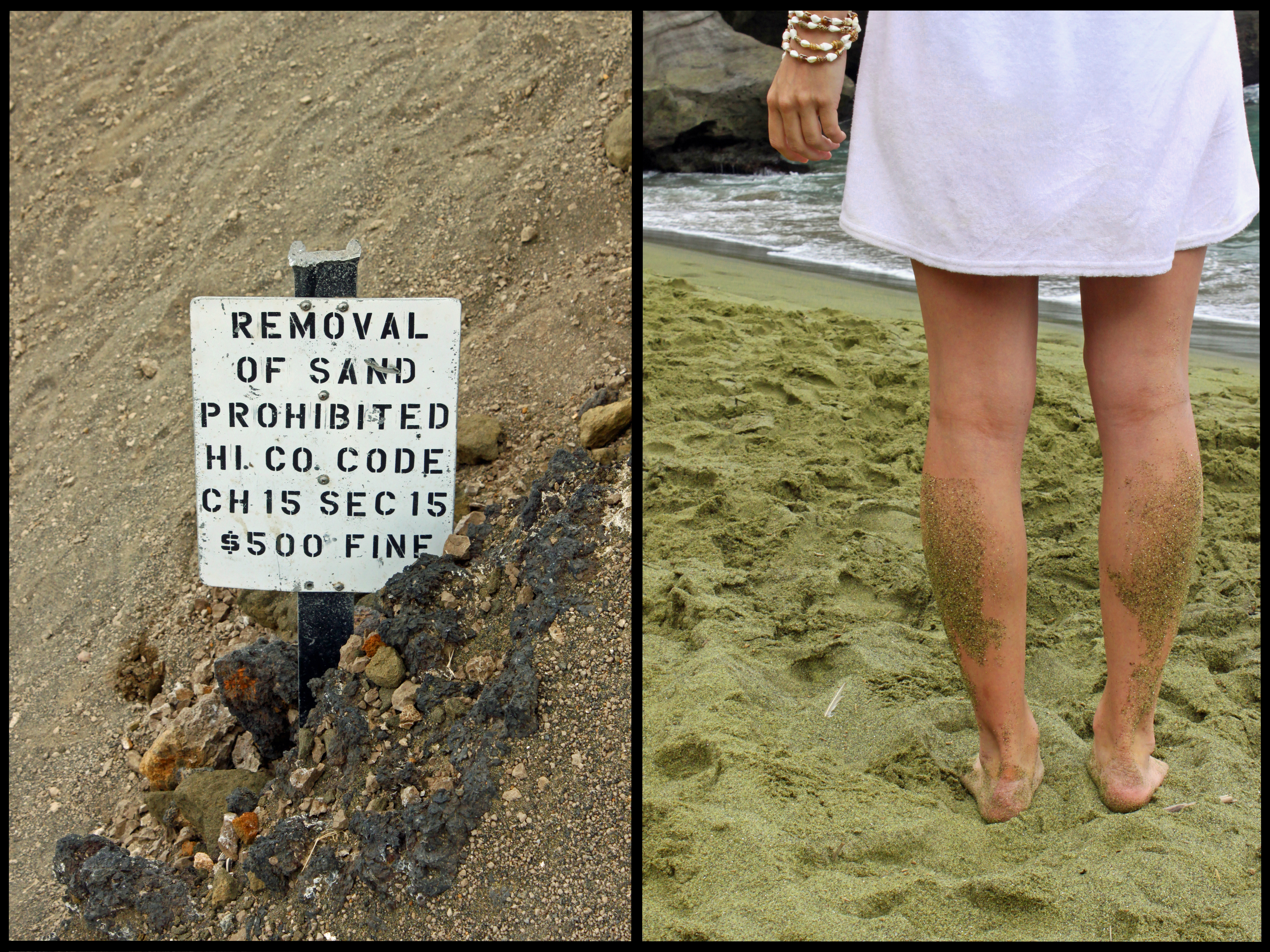
Papakōlea Beach, more commonly referred to as Green Sands Beach, is one of two green sands beaches in the world. As you’ll see later down, the sand didn’t look particularly green the day we were there, but the beach gets this distinction because the sand is made of volcanic olivine. While the rest of the volcanic deposits are washed away with the surf, the heavier olivine stays behind, creating a green sands beach. The only other place this is known to occur is on the Galapagos Islands, as mentioned above.
Green Sands is about a two mile walk from the parking lot. You can pay locals $5/person, or $15/car (it varies), to drive you there in 4WD, but it’s not something you would want to attempt with a rent-a-car. There are many different roads leading towards Papakōlea Beach, continuously intersecting. As long as you travel near the coastline, you should be able to tell when you’ve reached the beach, if only by the 4WD cars parked there.
The hike itself is very rocky and dusty, but thankfully we hiked on a cloudy day which made it a bit cooler. The dirt was so fine it was easy to imagine yourself trekking across Mars.
Once we arrived at the beach, we stopped briefly for a nice overlook and some severe disappointment. While I could sort of convince myself that the sand looked like a puke-green color, it mostly appeared to be a yellow-brown. We had a local with us, and he told us it would have looked greener on a non-cloudy day. We decided to enjoy it for then, but that we probably wouldn’t hike back. The picture below shows the view of the beach from the top viewpoint.
Papakōlea Beach is the remains of what was once the Puʻu Mahana cinder cone. Puʻu Mahana has now been carved out by the ocean, creating a small bay leading into the green sands beach. The remnants of the cinder cone can still be seen today with the steep, semi-circle cliff face that leads down onto the beach.
The picture below on the left is from the top of the cliff (which is why the sand looks even less green than above), and on the right is a picture from the beach itself. It’s a very steep climb to get down onto the beach, but we saw dogs scaling the incline without much issue. Humans get steps down, which helps a bit.
The water depth at this beach changes quite rapidly, but we all swam in the rough surf to wash off from our trek across Mars. We also witnessed more 30-foot cliff jumps here! After a short break from swimming to eat lunch, we began the journey back to the car. Our wet feet and shoes did a fantastic job of attracting the dirt we walked across, and this is the result of the two miles:
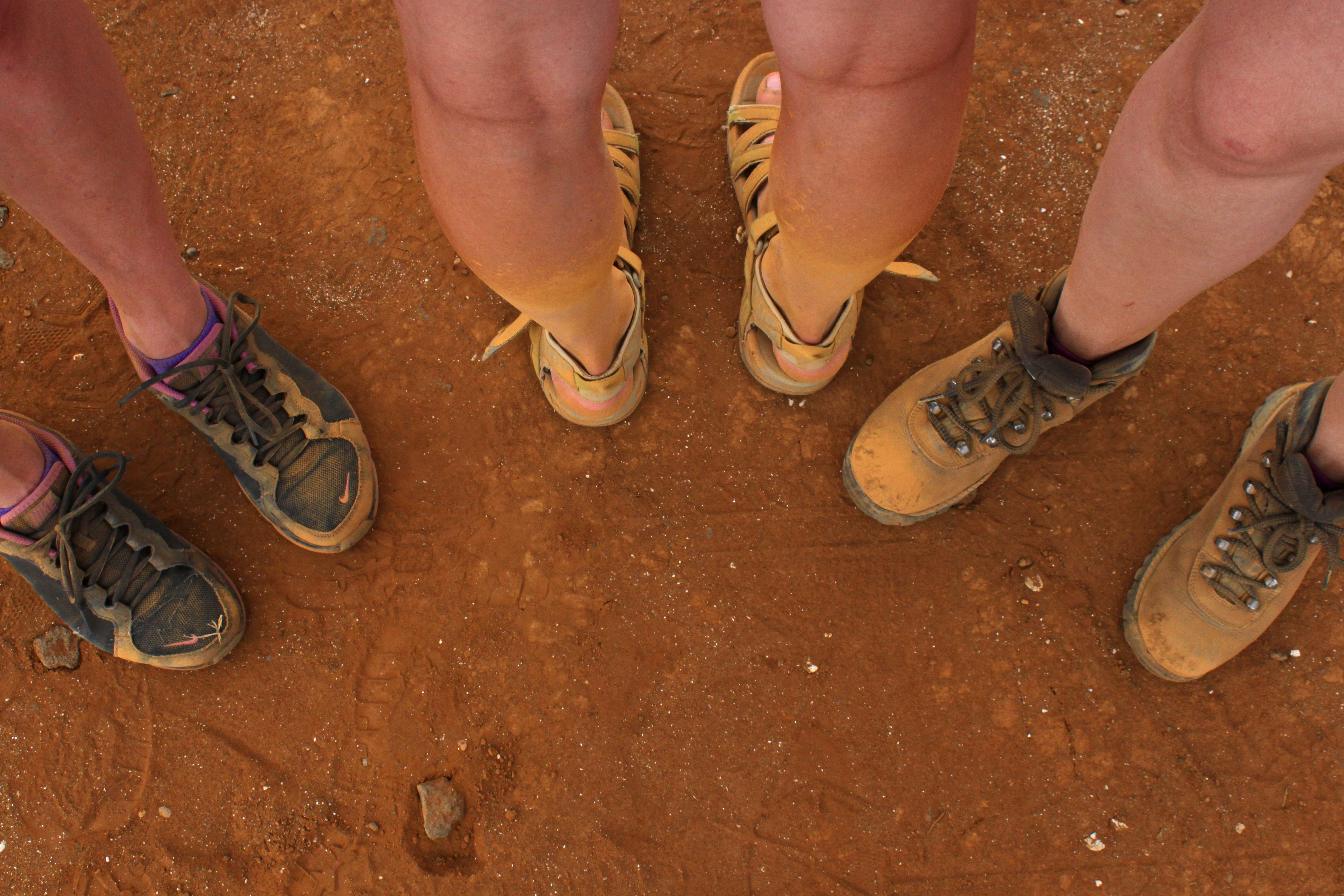
The shoes on the left used to be purple, the shoes in the middle used to be green and the shoes on the right were once a dark brown. Thankfully they have all been restored to their accurate coloring with just a few days time.
South Side Shaka
Finally, we ended our day at South Side Shaka, the southernmost bar in the USA. With a name like that, you think it would be a happening place, but I’m pretty sure our group tripled the total number of people in that restaurant (employees included). They had a relatively good selection of food, a small selection of beers and mixed drinks, and ten-year old kids to wait on the tables. It was a nice stop nonetheless, and I even bought a tee-shirt!
Stay on the lookout for new blog posts coming soon. Until next time!
Next Up: Mauna Kea Observing Run

It’s good reading your blog posts now that I have visited these spots with you!