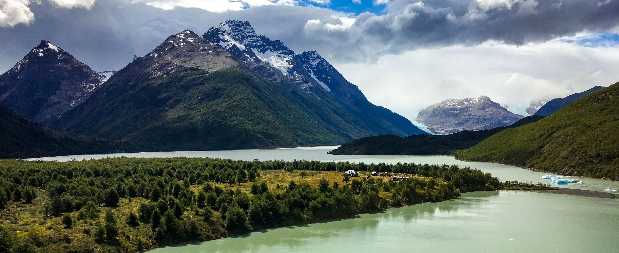
My first weekend on the Big Island was Memorial Day weekend, and I decided to take my first day trip on Monday. I had rented a car, so I wanted to put it to good use, but I also needed to save money. I decided to focus on the section of the magazine called the Hilo/Hamakua Coast, which runs from Hilo to Honoka’a. There were ten activities listed in this section, but most of them were in Hilo, so I saved those for next time. Shown below is a map of the Big Island and the section of the island I traversed on Monday.
This trip checked off #64 (Drive the Hamakua Coast), #72 (Visit Akaka Falls & Honomu Town) and #74 (Take a Break in Honoka’a).
I started my day at about 8:00am, since I wanted to hike down into Waipi’o Valley, which could take quite some time.
Akaka Falls was my first stop, since it’s only about twelve miles outside of Hilo on Highway 19.
The Scenic Route
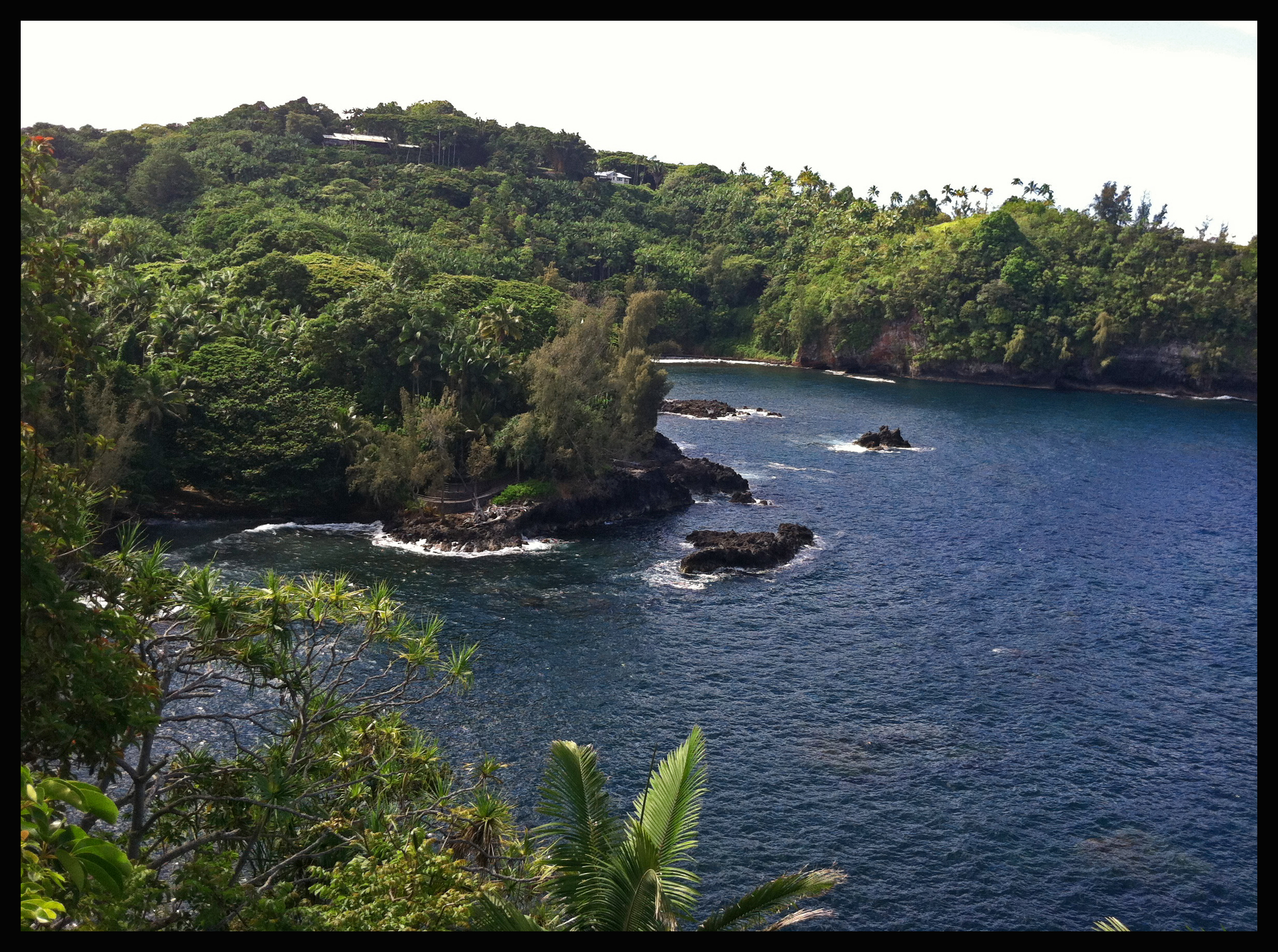
On the way to Akaka Falls, I was quickly diverted by the “Scenic Route,” which detours Highway 19 for four miles and cuts closely to the coastline. The coastline is blocked by the thick rainforest for most of the drive, except for one dramatic view. About halfway through the scenic route I began to wish I had taken a video of the drive, so I made sure to do it again on my way back at the end of the day. Unfortunately it was raining lightly during the video so I might try to take it again at a later point in time. Below is a sneak preview:
When you are traveling north (from Hilo toward Akaka Falls), you round a corner and see the ocean through the trees from atop a steep cliff. Unfortunately there is no great place to park at that overlook, but other people still managed to pull their cars over. Although I did not, I would highly recommend getting out for a few minutes to take in that view. The waves violently crashing against the cliffs juxtapose the peaceful feeling you have standing in the rainforest, only surrounded by the call of birds. The drive itself is definitely worth it – it seemed like it would take much longer but time flew by with the fantastic views.
Update: I know now this view is called Onomea Bay, and the botanical gardens right next door allow you to walk down to the ocean for spectacular views.
Honomu
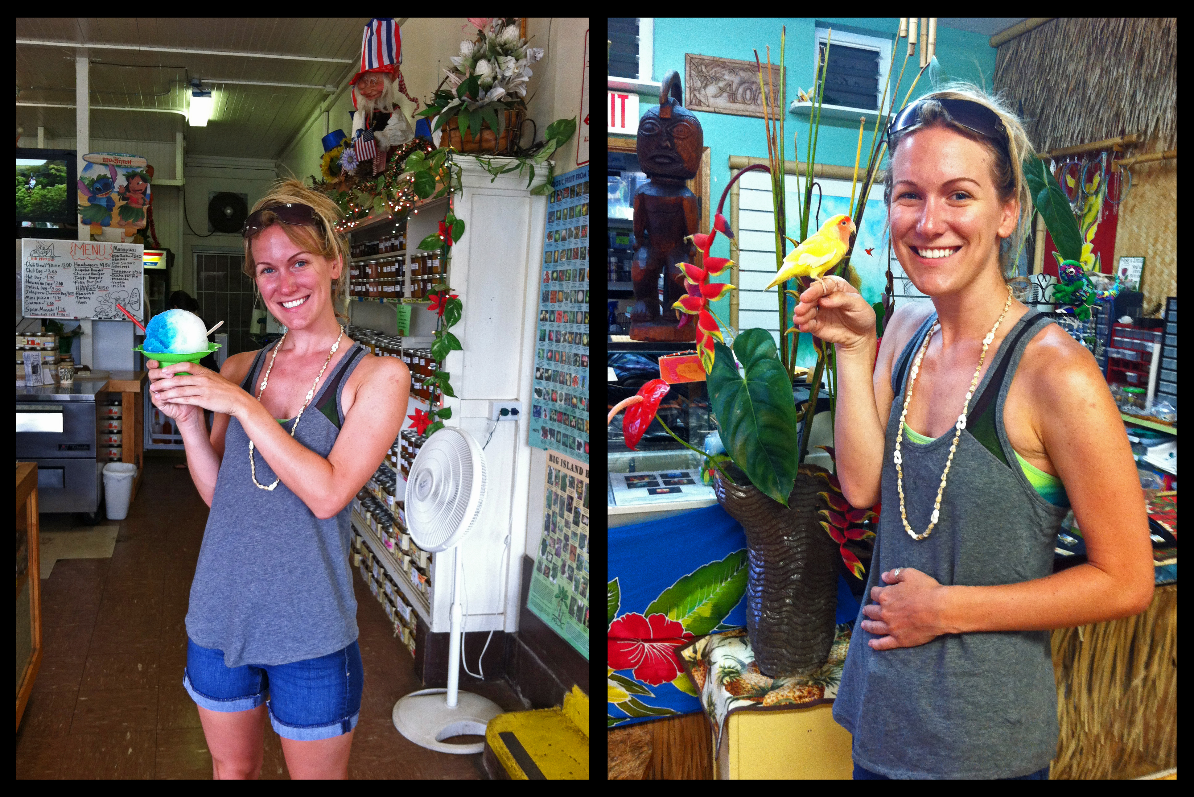
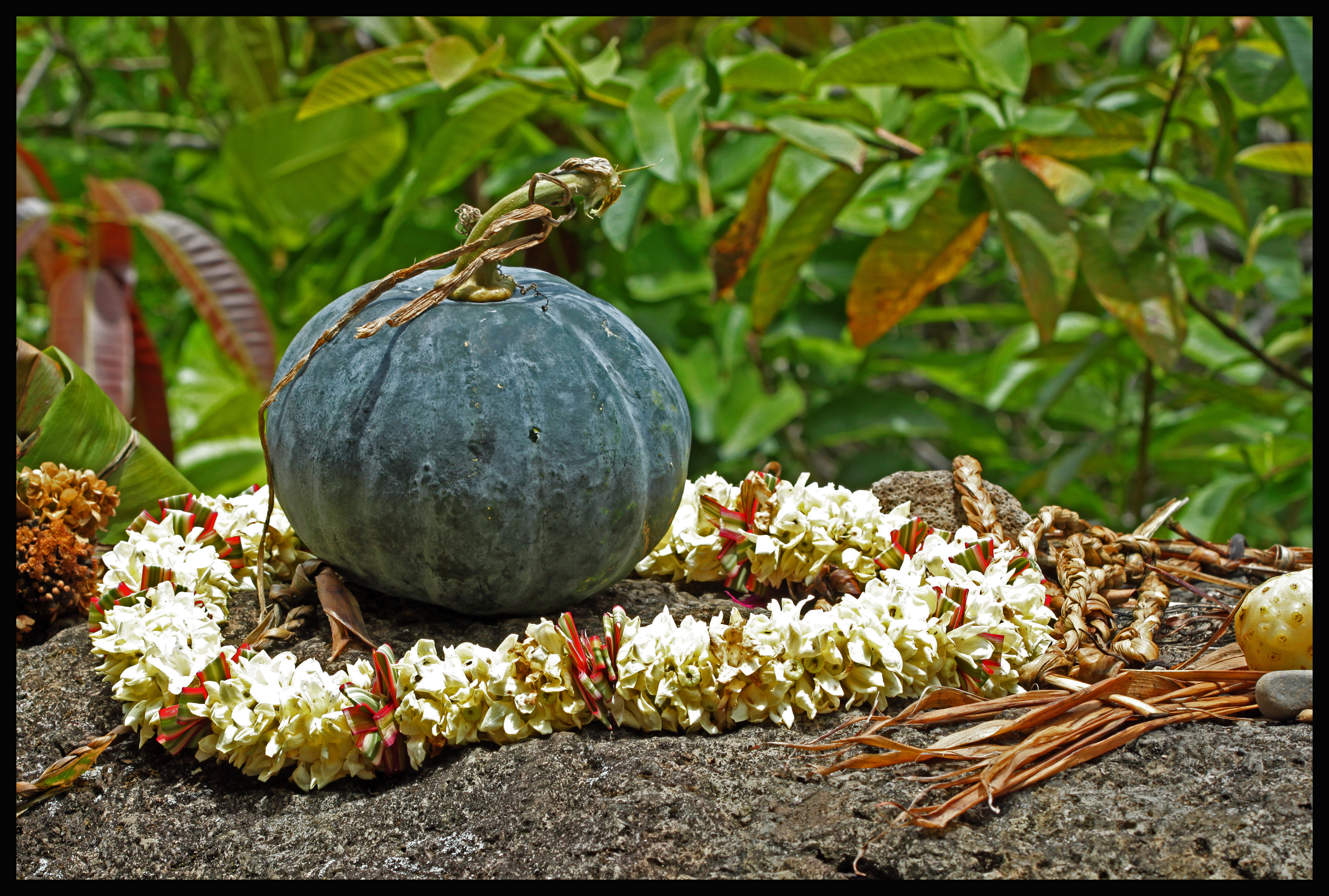
After reentering Highway 19, it is a very short drive to get to Honomu and Akaka Falls. Honomu is the small town just off Highway 19 that offers a nice mix of old and new. The town itself used to be much larger in population and had numerous sugar plantations. Today a few plantations and wineries remain, but the main source of income for the town is the tourism. As you drive through, you can see that the town has been relatively unaffected by tourism in that there are no grand hotels or malls, but the original boardwalks and buildings remain. My magazine tells me that Ishigo’s Grocery and Bakery is a century old! However, there are several stores that obviously cater to the tourists who are driving through to see the falls. Along the way to Akaka Falls there are a couple of stands selling fresh fruits and vegetables. Here’s a bit of what we encountered in Honomu:
Akaka Falls
Signs easily point you towards the parking lot at Akaka Falls. I got there at 8:30, when the park technically opened, although there were people already finishing the hike at that point. It was early enough that the maintenance workers were still there, and gave the first few arrivals a special tip: If you park within the parking lot gates, it’s a $5 fee. If you park along the road just outside of the gates, it’s a $1 fee because you are considered a “walk-in.” Both of these can be paid by credit/debit card at a machine towards the start of the hike, and restrooms are available as well.
The hike itself is only 0.4 miles but you could easily spend 45 minutes or so just stoping and staring at your surroundings every five feet. You can walk directly to Akaka Falls, or take the circular 0.4 mile route which has a stop-off point to see Kahūnā Falls. Both Kahūnā Falls and Akaka Falls stem from the Kolekole stream, which runs from Mauna Kea to the ocean. Taking the circular route first brings you past Kahūnā Falls.
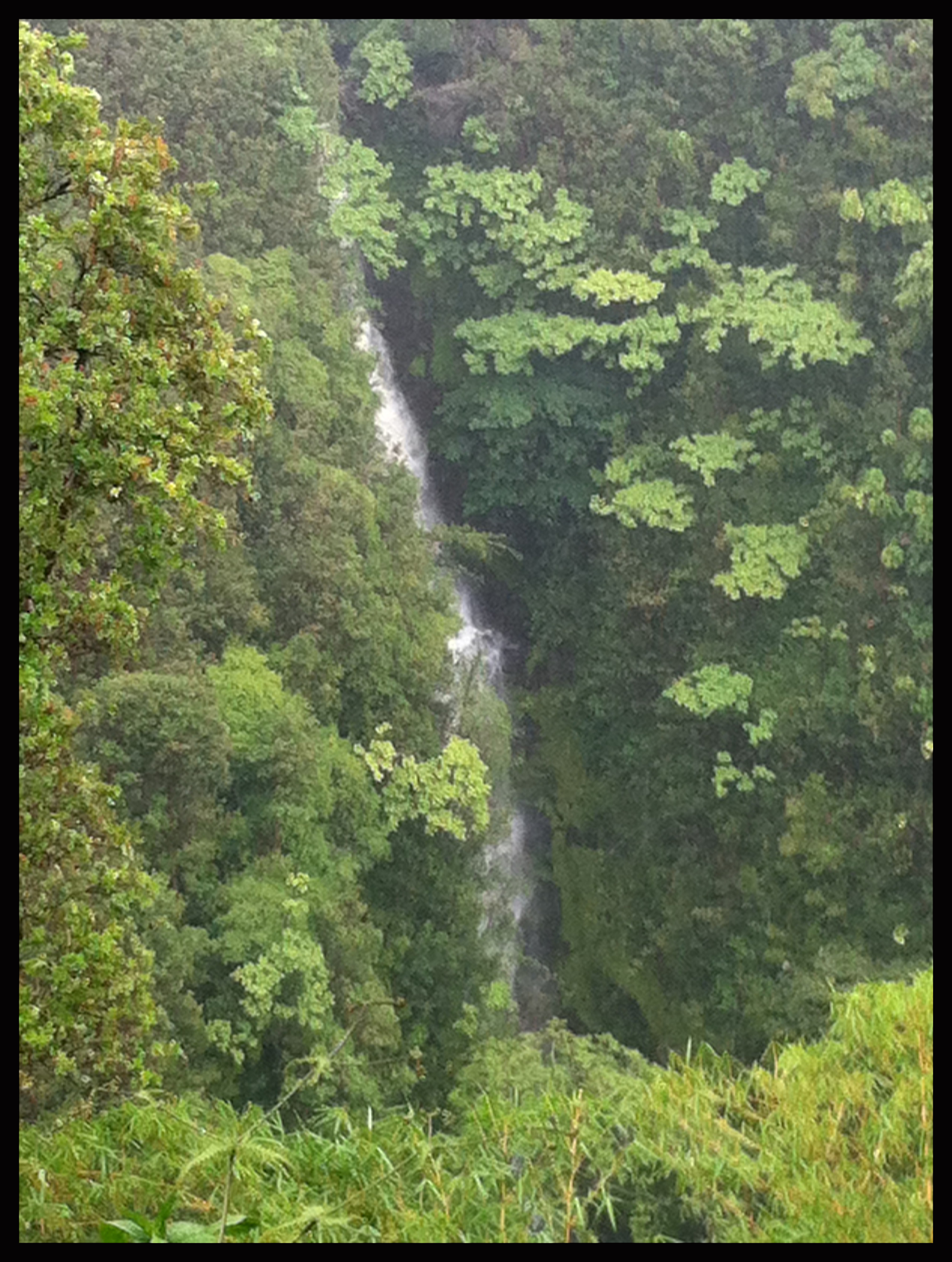
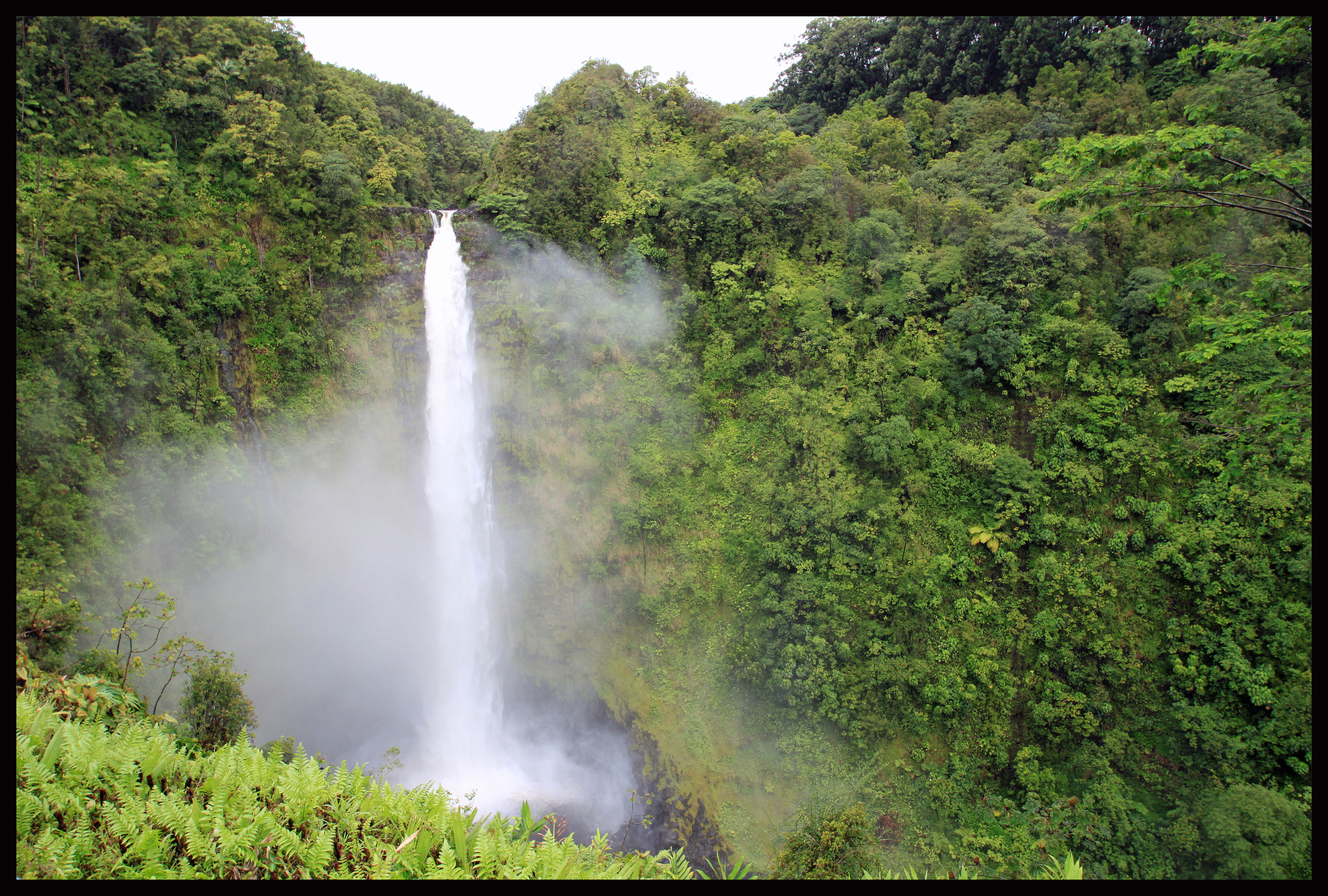
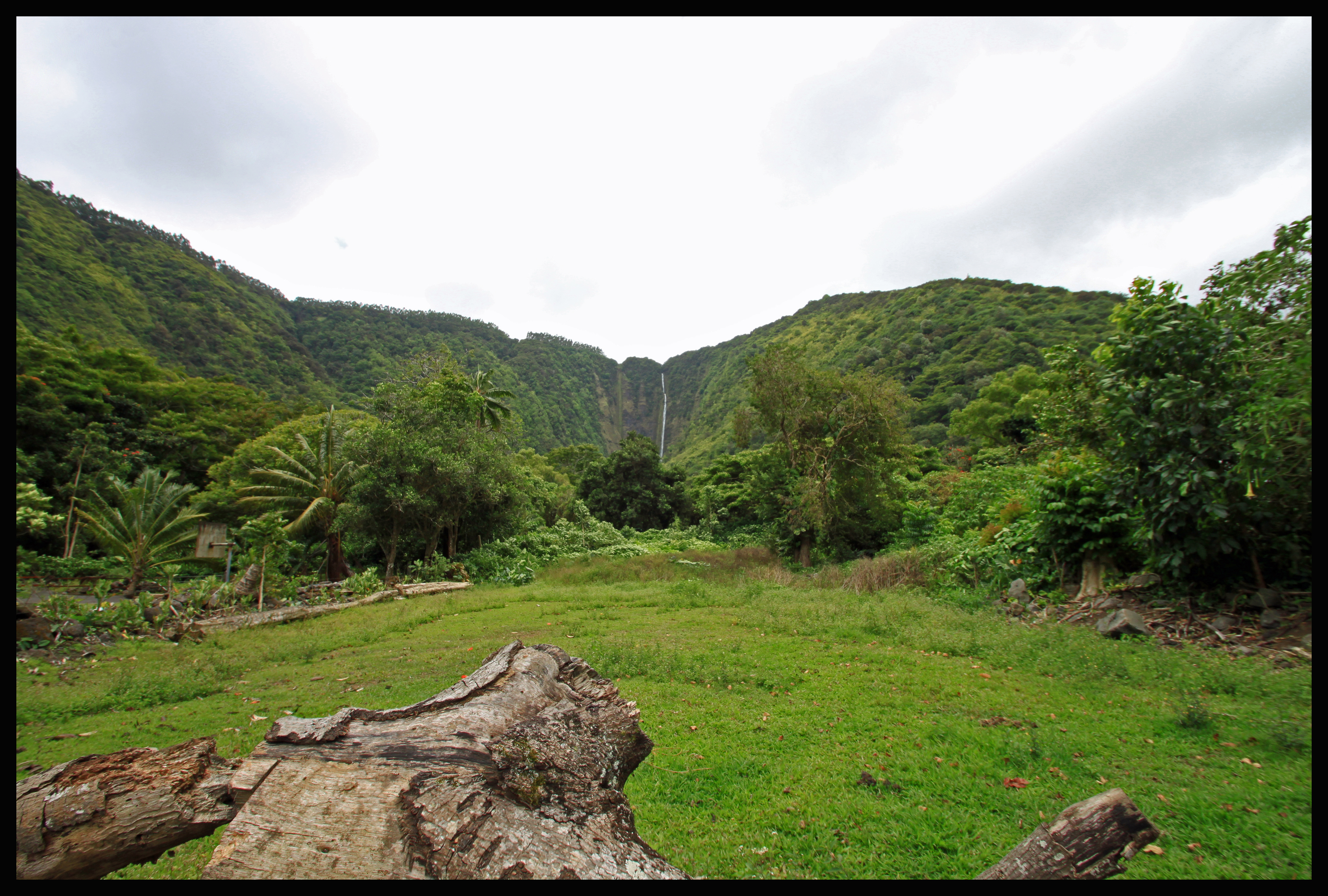
I quickly pressed on to Akaka Falls, which is 422 feet high – twice as high as Niagara Falls but also much skinnier! See for yourself:
The streams are populated by endemic Hawaiian fish that Hawaiians collectively refer to as ‘o’opu. These fish are born in fresh water streams, migrate to the ocean to grow into adulthood, and then move back to freshwater streams. These fish have muscular fins allowing them to cling on to surfaces in areas of strong flow. Their fins are so strong they frequently migrate UP the 422 foot waterfall! Watch this video and imagine doing that:
Overall I would highly recommend this hike. (It’s called a hike but it’s so quick and interesting it seems more like a quick walk down the street.) Some online reviews find it too touristy, and it certainly is touristy. But it takes a very short amount of time and provides spectacular views. There’s no excuse to miss this (unless you hate waterfalls)!
Waipi’o Valley
Next on my drive was Waipi’o Valley, shortly outside of Honoka’a. Exit Highway 19 onto Mamane Street, also referred to as 240. After about ten miles turn left onto Waipi’o Valley road which should lead you to the overlook after the road takes a sharp right. If you’re following along on the map, I made it to the northern tip of the island. Being from the mainland, I’ve noticed I expect everything to take much longer than it should. To drive a quarter of the island along Highway 19 only took maybe an hour and fifteen minutes. Not to mention the drive is filled with great scenery and ocean overlooks. I can see why it got it’s own number in my magazine.
Waipi’o Valley is one of seven valleys stretching into the ocean from Kohala Mountain. Sometimes referred to as “The Valley of Kings, it used to be the home of King Kamehameha I as well as an important political center for Hawaii in the early 1800s. In 1946 a tsunami wiped out most of the settlement, and little remains today.
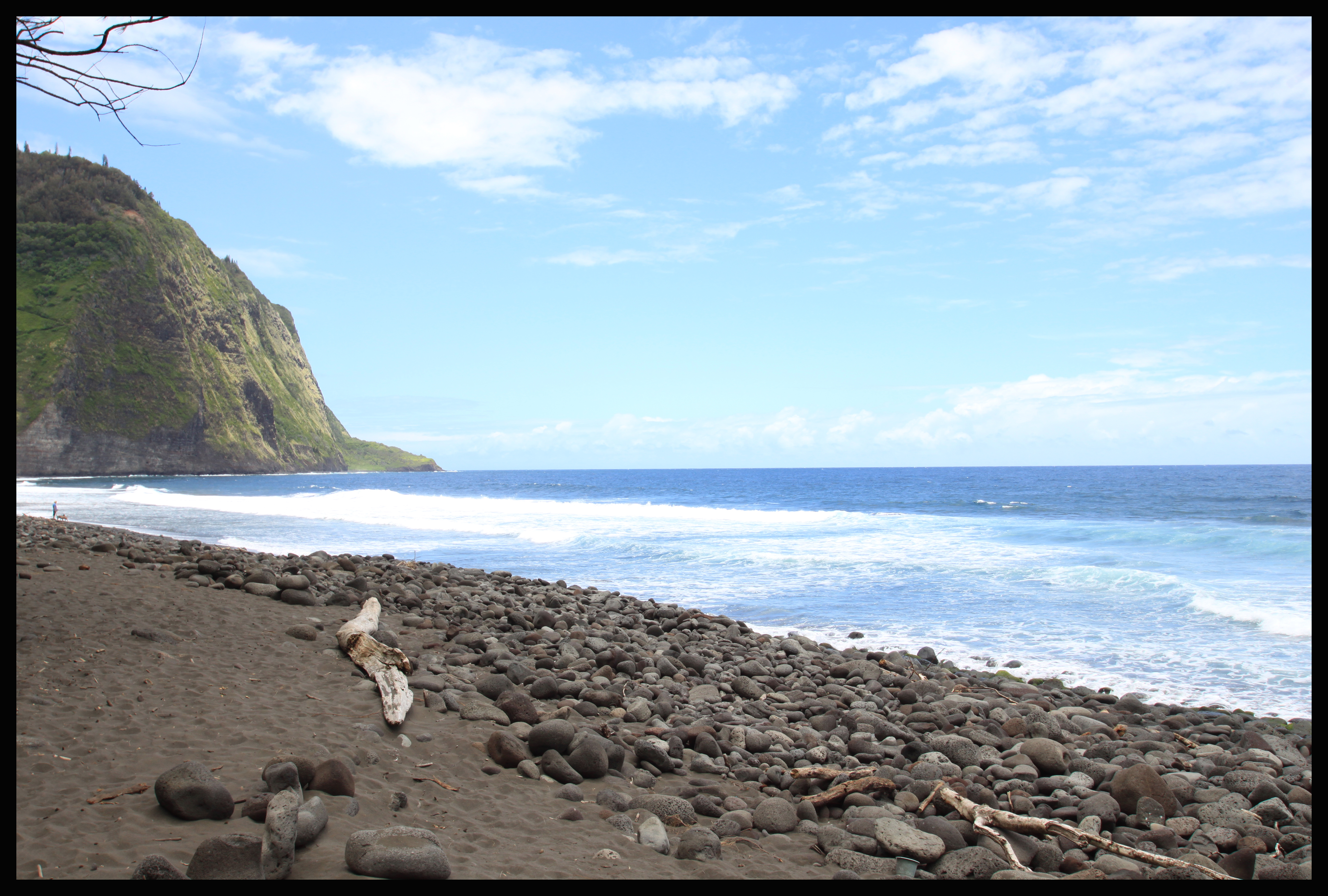
At Waipi’o Valley you are able to look down 2000 feet toward the ocean and to an extremely small town of Hawaiian residents that prefer an out-of-the-way, private lifestyle. By town I mean neighborhood, and by extremely small I mean the estimate I’ve heard is 60-70 people. That might be generous based on the part I walked through. Some readings will describe frequent property right conflicts down in the valley, or an unpleasant attitude toward tourists. For these reasons I personally made sure to abide by all of the “No Trespassing” signs and stay on the public main roads while I was exploring their land. The road into the valley is however classified as a public road, so walking down should not be an issue. The Waipi’o Valley overlook is a stopping point for many people. Parking is free, but the lot is mostly limited to about ten minutes with some half hour spaces. The overlook affords views seen below:
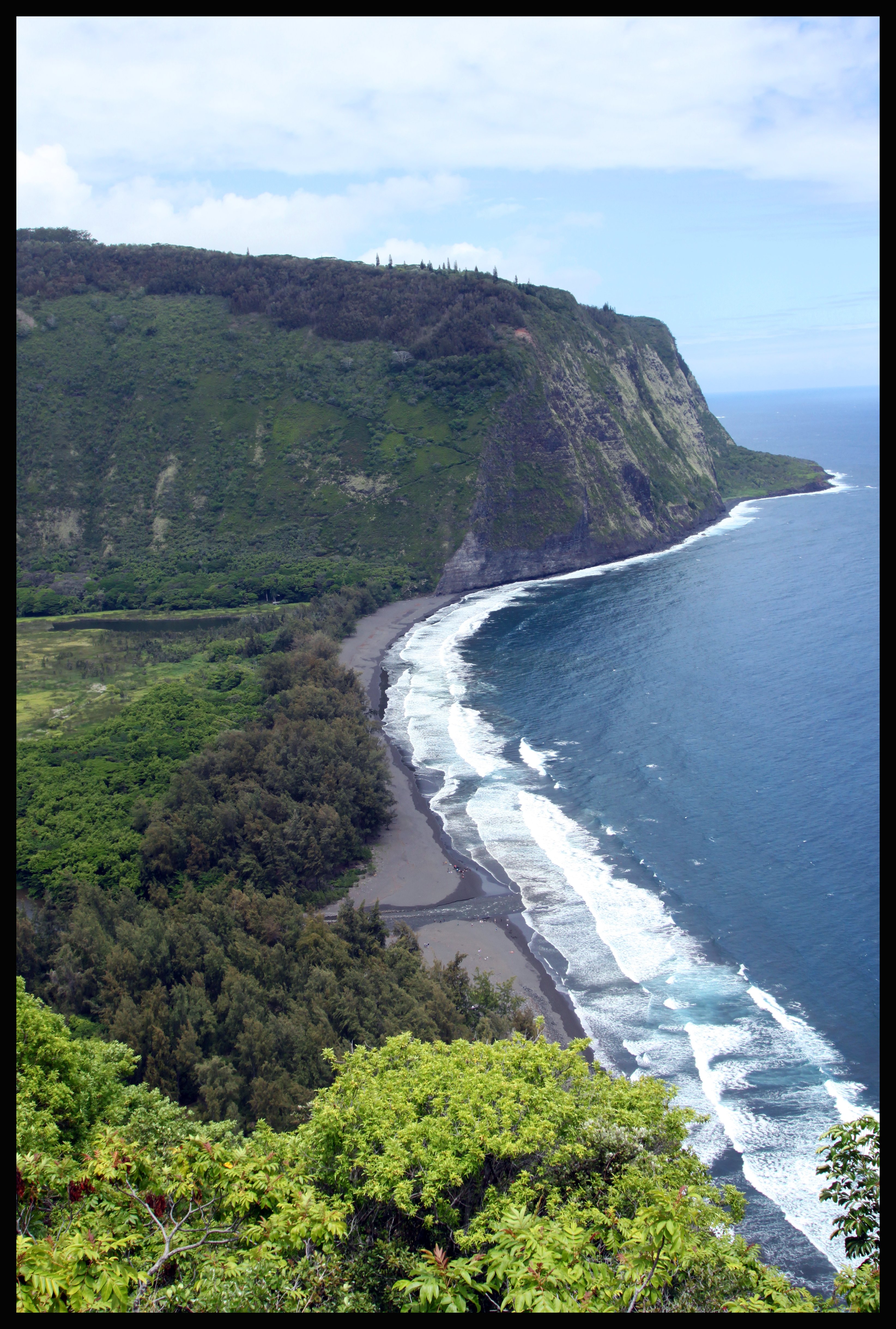
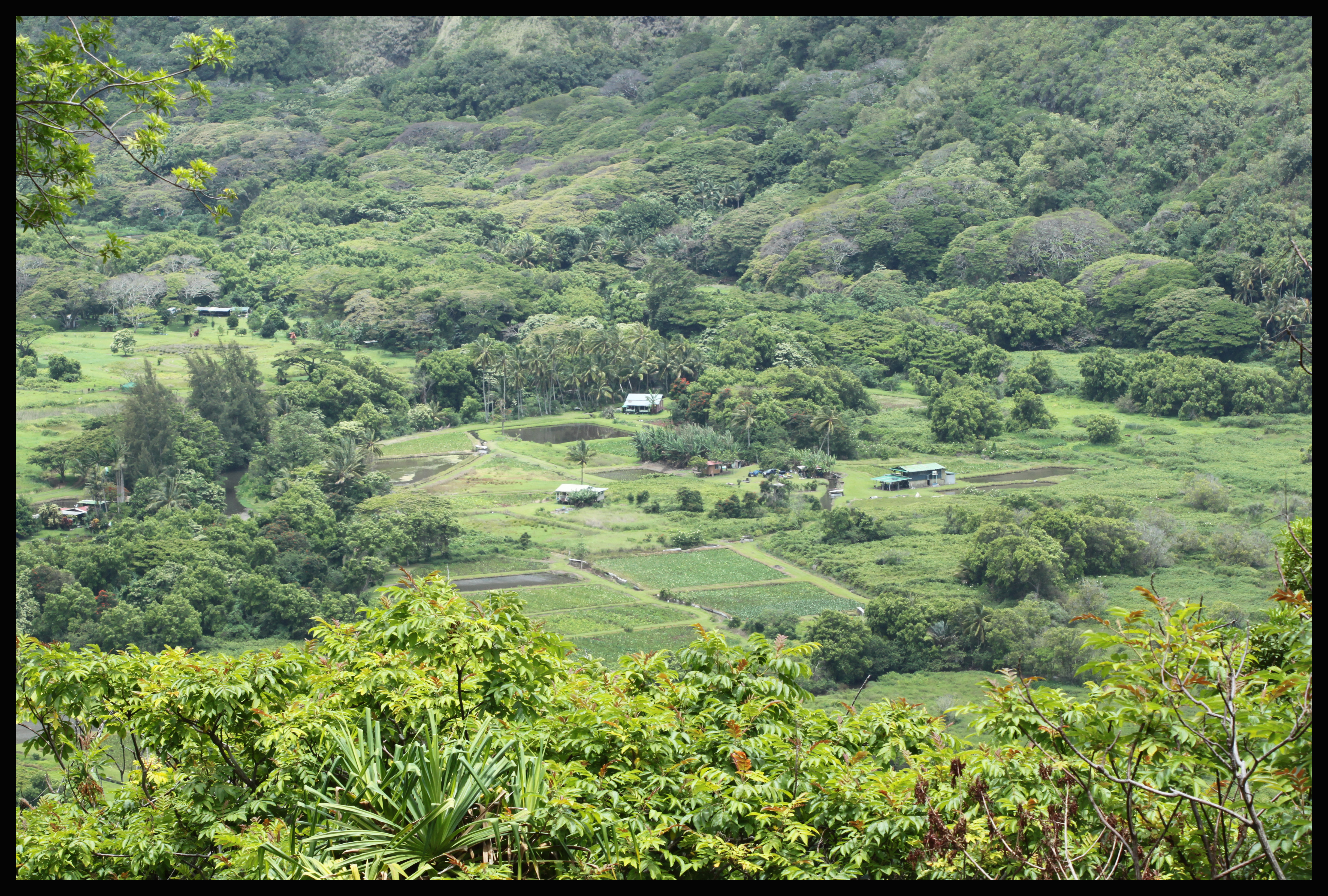
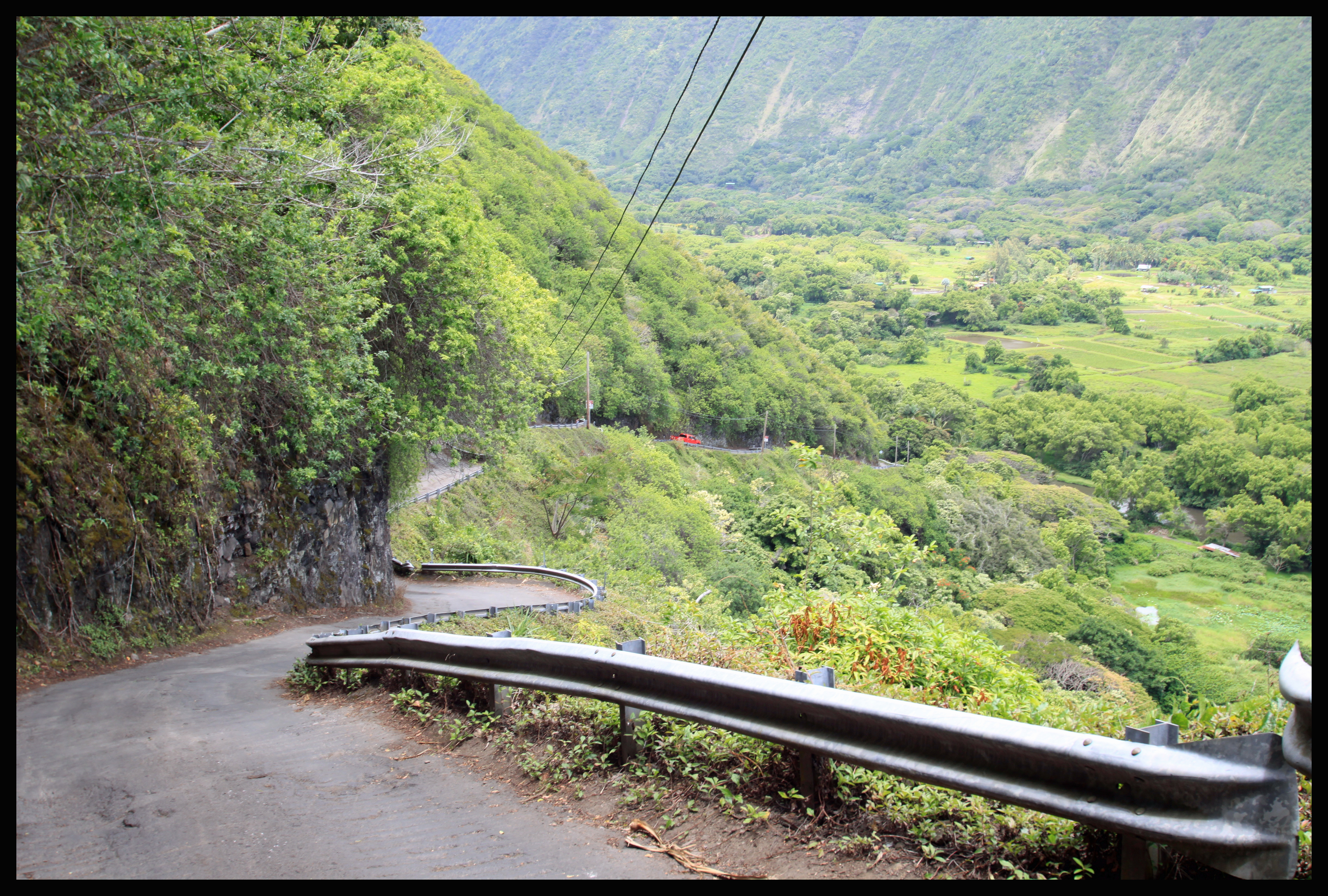
The first image is looking towards the right, and outside of the valley towards the ocean. The second image looks down into the valley towards the remaining settlement. There are still some taro farms down in the valley that can be seen in the second picture. Most tourists will walk down a steep path to the overlook, snap a few pictures, and continue on their journey. However, there are complete tours that go down into the valley. The catch here is that the road going into this valley is an impressive 25% AVERAGE grade, about a mile in length. According to Wikipedia, if this qualifies as a public road, it would be the steepest in the United States and perhaps even the world. While anyone can travel down this road, you MUST have four-wheel drive, which is why many people elect to take one of the tour options. The other option is to walk down into the valley, which is what I decided to do. I will say right off the bat – I am happy to say I did this hike, but I wouldn’t do it again. The road is hard on the knees going down, and exhausting on the way up. However, when you have four months here, you might as well experience everything to the fullest. I highly recommend bringing a small snack or lunch to enjoy while you rest at the bottom. You will have to walk along the main road and make sure to clear the way for any vehicles going up or down. In many places the road is only wide enough for one car. All the same, I saw many other people making the journey on foot. Although pictures don’t really do it justice, I’ve included one picture of the road below. Notice the red car off in the distance, looking like it’s at a 45-degree angle on the road.
I also spotted the image below on my way down. I’m honestly not sure if it was something ceremonial or just something made to look pretty, but there weren’t any nearby supplies to make this with, which makes me doubt other tourists brought it along.
When you finally make it to the bottom (hopefully in one piece), you have two options. The left hand route takes you towards what I imagine is the main neighborhood (no shops of any kind down there) and also towards Hi’ilawe Falls. The right branch takes you toward the ocean. Again, as this would probably be my only time hiking down into the valley, I decided to take both routes. Online reviews seem as if most tourists just do one or the other though.
I first branched off toward the left and after maybe a quarter mile you can round a corner and see the falls for the first time. Continuing to walk will take you on what appears to be the main road and past about six houses. There is eventually a trail that branches off toward the left again, which seems as if it would lead to the falls. Walking along that trail I saw several more houses as well as an entire stable’s worth of horses. The picture below was taken from the main road in town. Stemming from the Lalakea Stream, Hi’ilawe Falls drops almost 1500 feet! I guess my day was lucky, because I have seen in other reviews that due to damming, the waterfalls are sometimes dry.
After Hi’ilawe Falls, I rerouted and took the righthand branch toward the ocean. This was only about a mile toward the ocean on fairly level ground. Most people seem to take the ocean route, and it was very popular while I was there. There also seemed to be a mix of Waipi’o Valley locals out for the day and other local Hawaiians who had driven down for the day. Many people were playing music out of their cars as they ate lunch and swam. Below is one of the pictures from the ocean.
As you can predict, the hike back up was fairly awful, but I had the promise of lunch to keep me going!
One more note: On the very first image overlooking Waipi’o Valley, on the other side of the valley you can see where the land rises again. If you look carefully, you can also spot a path leading up that side. Two switchbacks stick out amongst the trees. If you were to hike up that side you would end up in the next valley over, another one stemming from Kohala Mountain. Some people go camping there (including some of the scientists at Gemini), but you need a permit and you have to make quite the hike. I’ve been told it’s absolutely stunning and even more isolated than Waipi’o Valley in terms of both tourists and residents.
Honoka’a
To get to Waipi’o Valley I had to drive through most of Honoka’a where I saw several small shops selling trinkets and treats. I even came across one local trying to sell his baby ducks. Although I was mainly on the hunt for fudge, I spent a few minutes walking up and down the main stretch of Honoka’a before I returned to my car and headed off to lunch.
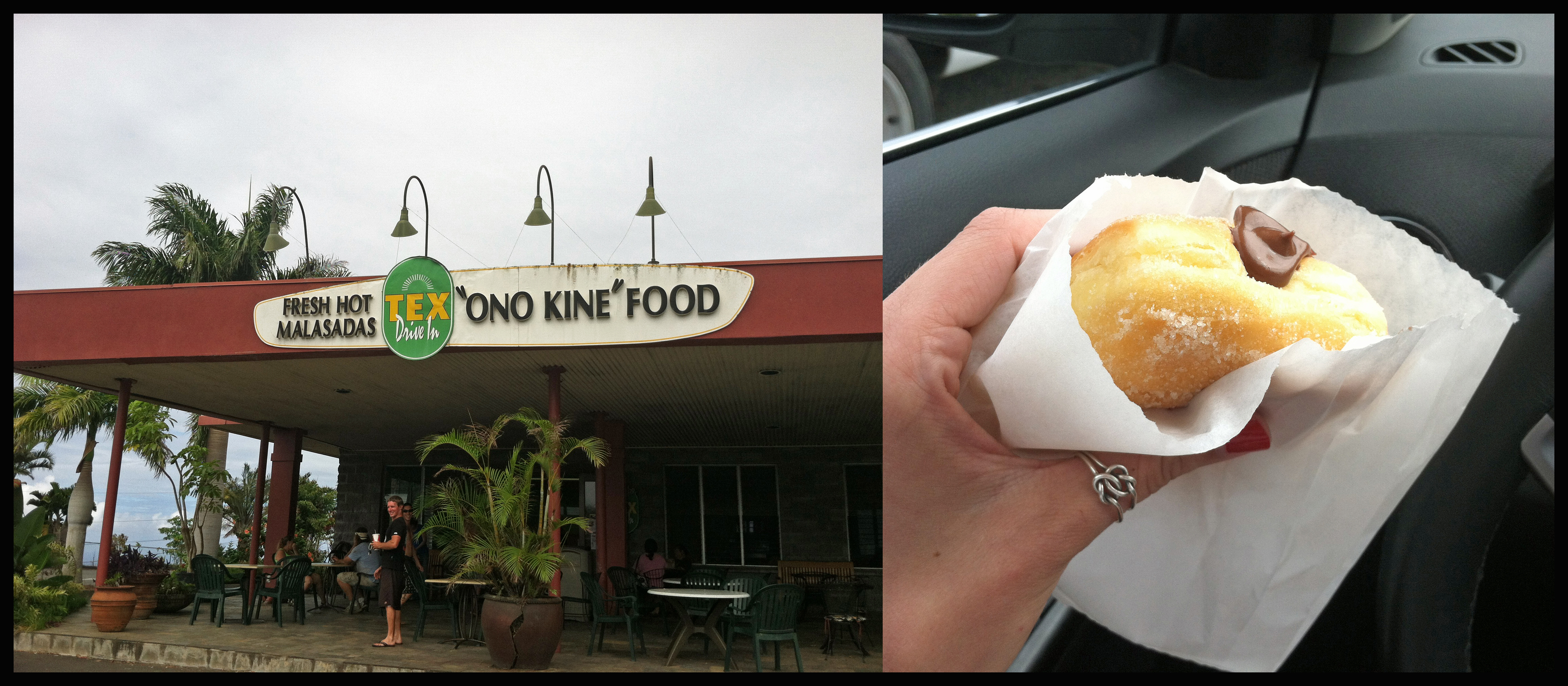
Tex Drive-In
Tex Drive-In was recommended to me by several locals down here in Hilo, and also by my magazine. After that hike down into Waipi’o Valley, I was looking forward to it. I can’t say I enjoyed my lunch very much, but the real reason to come here is apparently for the malasadas, which is like the Hawaiian version of a donut. They’re actually Portuguese, and Wikipedia has a much more delicious description than I could give: “A malasada (or malassada, from Portuguese “mal-assada” = “light-roasted”) (similar to filhós) is a Portuguese confection, made of egg-sized balls of yeast dough that are deep-fried in oil and coated with granulated sugar.” Is your mouth watering yet? You can get them plain or have them injected with fruits and creams. I chose chocolate for my first malasada experience, and I plan on having many more!
After the Tex Drive-In experience it was sadly time for me to return home. Just getting out of the Hilo rain for a couple of hours was nice though, and new adventures awaited me the next day. The next day was my first workday at Gemini! Check back soon for new trips and experiences!
-Emily
Next Up: Kona by Day and Night
